Morgan City in St. Mary Parish, Louisiana — The American South (West South Central)
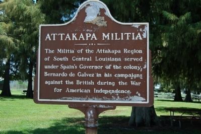
Attakapa Militia
Erected 1976 by American Revolutionary Bicentennial Committee.
Topics and series. This historical marker is listed in these topic lists: Settlements & Settlers • War, US Revolutionary. In addition, it is included in the The Spirit of ’76, America’s Bicentennial Celebration series list.
Location. 29° 41.737′ N, 91° 11.275′ W. Marker is in Morgan City, Louisiana, in St. Mary Parish. Marker is on Myrtle St., 0.3 miles north of Auditorium Dr., on the right when traveling south. Touch for map. Marker is in this post office area: Morgan City LA 70381, United States of America. Touch for directions.
Other nearby markers. At least 8 other markers are within 2 miles of this marker, measured as the crow flies. Dr. Walter Brashear (here, next to this marker); Fort Star (approx. 0.8 miles away); Mount Pilgrim Baptist Church (approx. one mile away); Civil War Years (approx. one mile away); Sacred Heart Of Jesus Church (approx. 1.1 miles away); First Offshore Oil Well (approx. 1.1 miles away); The Governor Jared Young Sanders Memorial Monument (approx. 1.2 miles away); Charles Morgan (approx. 1.3 miles away). Touch for a list and map of all markers in Morgan City.
Credits. This page was last revised on July 3, 2022. It was originally submitted on July 18, 2015. This page has been viewed 488 times since then and 23 times this year. Photo 1. submitted on July 18, 2015. • Andrew Ruppenstein was the editor who published this page.
Editor’s want-list for this marker. A wide view photo of the marker and the surrounding area in context. • Can you help?
