Mobile in Mobile County, Alabama — The American South (East South Central)
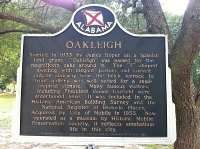
Oakleigh
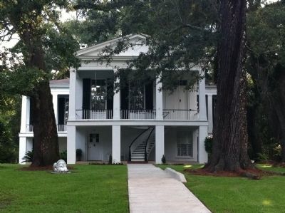
Acquired by City of Mobile in 1955. Now operated as a museum by Historic Mobile Preservation Society, it reflects antebellum life in this city.
Erected 1985 by Alabama Historical Association - Historic Mobile Preservation Society.
Topics and series. This historical marker is listed in these topic lists: Government & Politics • Settlements & Settlers. In addition, it is included in the Alabama Historical Association, and the Former U.S. Presidents: #20 James A. Garfield series lists. A significant historical year for this entry is 1833.
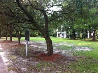
Location. 30° 40.87′ N, 88° 3.596′ W. Marker is in Mobile, Alabama, in Mobile County. Marker is at the intersection of Oakleigh Place and Savannah Street, on the left when traveling north on Oakleigh Place. Touch for map. Marker is at or near this postal address: 300 Oakleigh Place, Mobile AL 36604, United States of America. Touch for directions.
Other nearby markers. At least 8 other markers are within walking distance of this marker. Home of Joe Cain (approx. 0.3 miles away); Confederate Rest (approx. 0.4 miles away); Jewish Rest Magnolia Cemetery (approx. 0.4 miles away); The Bee Hive (approx. half a mile away); Protestant Children's Home (approx. half a mile away); Grace Lutheran Church (approx. half a mile away); Battle of Fort Blakely Monument (approx. half a mile away); Emerson Institute (approx. 0.6 miles away). Touch for a list and map of all markers in Mobile.
Credits. This page was last revised on January 25, 2021. It was originally submitted on July 25, 2014, by I.G.V.Atajar of San Jose, California. This page has been viewed 759 times since then and 31 times this year. Last updated on July 21, 2015, by J. Makali Bruton of Accra, Ghana. Photos: 1, 2, 3. submitted on July 25, 2014, by I.G.V.Atajar of San Jose, California. • Bernard Fisher was the editor who published this page.
Editor’s want-list for this marker. Photo of marker when it is to be refurbished shortly (3.12.24) • Can you help?


