Walpole in Cheshire County, New Hampshire — The American Northeast (New England)
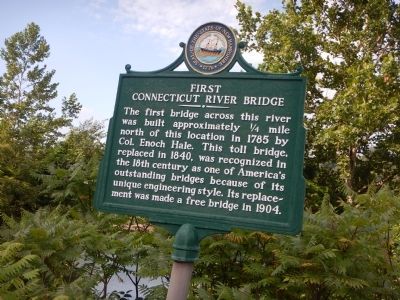
First Connecticut River Bridge
The first bridge across this river was built approximately ¼ mile north of this location in 1785 by Col. Enoch Hale. This toll bridge, replaced in 1840, was recognized in the 18th century as one of America's outstanding bridges because of its unique engineering style. Its replacement was made a free bridge in 1904.
Erected by New Hampshire Division of Historical Resources. (Marker Number 061.)
Topics and series. This historical marker is listed in this topic list: Bridges & Viaducts. In addition, it is included in the New Hampshire Historical Highway Markers series list. A significant historical year for this entry is 1785.
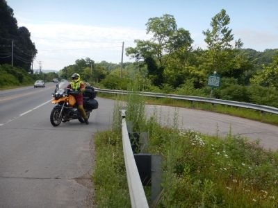
Location. 43° 7.706′ N, 72° 26.243′ W. Marker is in Walpole, New Hampshire, in Cheshire County. Marker is on Main Street (New Hampshire Route 12) half a mile south of Bridge Street, on the right when traveling south. Touch for map. Marker is in this post office area: Walpole NH 03608, United States of America. Touch for directions.
Other nearby markers. At least 8 other markers are within 4 miles of this marker, measured as the crow flies. Bellows Falls Canal (approx. half a mile away in Vermont); Hotel Windham / Andrews Inn (approx. half a mile away in Vermont); Waypoint Center (approx. 0.6 miles away in Vermont); Bellows Falls (approx. 0.6 miles away in Vermont); John Kilburn Cabin (approx. one mile away); Rev. John Williams (approx. 3.6 miles away in Vermont); The Westminster Massacre (approx. 4 miles away in Vermont); Court House (approx. 4.1 miles away in Vermont).
Credits. This page was last revised on June 16, 2016. It was originally submitted on July 22, 2015, by Kevin Craft of Bedford, Quebec. This page has been viewed 479 times since then and 43 times this year. Photos: 1, 2. submitted on July 22, 2015, by Kevin Craft of Bedford, Quebec. • Bill Pfingsten was the editor who published this page.

