Franklin in St. Mary Parish, Louisiana — The American South (West South Central)
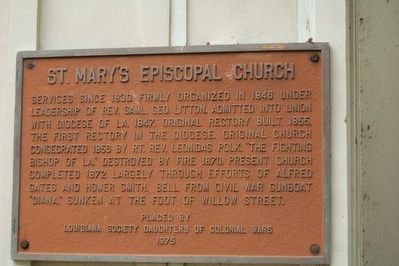
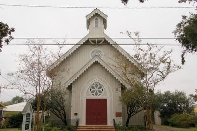
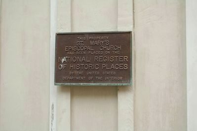
St. Mary's Episcopal Church
Erected 1975 by Louisiana Society Daughters of Colonial Wars.
Topics and series. This historical marker is listed in these topic lists: Churches & Religion • War, US Civil. In addition, it is included in the Daughters of Colonial Wars series list. A significant historical year for this entry is 1830.
Location. 29° 47.623′ N, 91° 30.136′ W. Marker is in Franklin, Louisiana, in St. Mary Parish. Marker is on 1st. Street south of Adams Street, on the right when traveling south. Touch for map. Marker is at or near this postal address: 805 First St, Franklin LA 70538, United States of America. Touch for directions.
Other nearby markers. At least 8 other markers are within walking distance of this marker. German Prisoner of War Camp (approx. 0.2 miles away); Bayou Teche (approx. 0.2 miles away); Charles Austin O'Niell (approx. 0.2 miles away); Franklin (approx. 0.2 miles away); Jared Young Sanders (approx. 0.2 miles away); The Gunboat Diana (approx. 0.2 miles away); Battle Of Irish Bend (approx. 0.2 miles away); St. Mary Parish Confederate Soldiers Monument (approx. ¼ mile away). Touch for a list and map of all markers in Franklin.
Credits. This page was last revised on April 20, 2017. It was originally submitted on August 1, 2015. This page has been viewed 359 times since then and 11 times this year. Photos: 1, 2, 3. submitted on August 1, 2015. • Bernard Fisher was the editor who published this page.


