Sorrel in St. Mary Parish, Louisiana — The American South (West South Central)
Sorrel
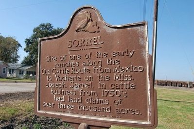
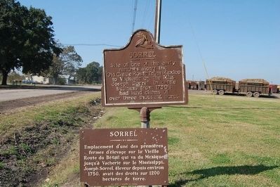
Site of one of the early ranches along the Old Cattle Route from Mexico to Vacherie on the Miss. Joseph Sorrel, in cattle business from 1750's had land claims of over three thousand acres.
Emplacement d'uné des premieres fermes d'élevage sur la Vielle Route du Bétail qui va du Mexique jusqu'à Vacherie sur le Mississippi. Joseph Sorrel, éleveur depuis environ 1750, avait des droits sur 1200 hectares de terre.
Erected 1964 by Department of Commerce and Industry.
Topics. This historical marker is listed in these topic lists: Industry & Commerce • Settlements & Settlers. A significant historical year for this entry is 1750.
Location. 29° 53.491′ N, 91° 37.089′ W. Marker is in Sorrel, Louisiana, in St. Mary Parish. Marker is on State Highway 182, 0.1 miles south of State Highway 318, on the right when traveling north. Touch for map. Marker is at or near this postal address: 20056 LA-182, Jeanerette LA 70544, United States of America. Touch for directions.
Other nearby markers. At least 8 other markers are within 7 miles of this marker, measured as the crow flies. Nicholas Provôt (approx. 2.8 miles away); St. John The Evangelist Church Parish (approx. 3.6 miles away); Harry B. Hewes House (approx. 3.6 miles away); Bayside Plantation (approx. 4.7 miles away); Alice Plantation House (approx. 5.2 miles away); Bayou Teche (approx. 5.4 miles away); Chitimacha Veterans' Monument (approx. 5.4 miles away); Beau Pre-Circa 1828 (approx. 6.9 miles away).
Also see . . . Pousser Des bêtes, Lost History of the Atchafalaya. LOUISIANA CATTLE DRIVES IN THE ATCHAFALAYA HERITAGE AREA
By Cliff LeGrange with Stella Carlin Tanoos (Submitted on October 18, 2018, by Kenneth Ramagost of Unknown, Louisiana.)
Credits. This page was last revised on October 18, 2018. It was originally submitted on August 2, 2015. This page has been viewed 905 times since then and 33 times this year. Photos: 1, 2. submitted on August 2, 2015. • Bernard Fisher was the editor who published this page.

