Opelousas in St. Landry Parish, Louisiana — The American South (West South Central)
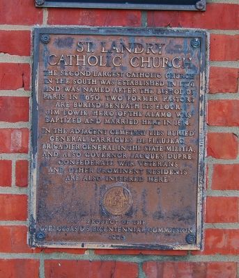
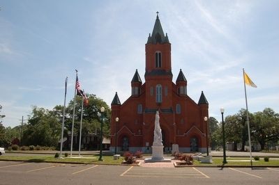
St. Landry Catholic Church
In the adjacent cemetery lies buried General Garrigues de Flaujeac, Brigadier General in the State militia, and also Governor Jacques Dupre. Confederate war veterans and other prominent resident are also interred here.
Erected 1976 by Opelousas U.S.Bicentennial Commission.
Topics. This historical marker is listed in these topic lists: Cemeteries & Burial Sites • Churches & Religion. A significant historical year for this entry is 1776.
Location. 30° 32.606′ N, 92° 4.776′ W. Marker is in Opelousas, Louisiana, in St. Landry Parish. Marker is on North Main Street (State Highway 182) north of East Church Street, on the right when traveling north. Located to the right side of main entrance to church on outside wall. Touch for map. Marker is at or near this postal address: 1020 N Main St, Opelousas LA 70570, United States of America. Touch for directions.
Other nearby markers. At least 8 other markers are within walking distance of this marker. Lt. Fr. Joseph "Verbis" Lafleur (a few steps from this marker); a different marker also named St. Landry Catholic Church (within shouting distance of this marker); St. Landry Catholic Cemetery (about 300 feet away, measured in a direct line); Opelousas Catholic School (approx. 0.2 miles away); Black Academy At Mt. Olive Baptist Church (approx. 0.2 miles away); Bloch Corner (approx. 0.7 miles away); City Hall (approx. 0.7 miles away); Budd's Corner (approx. 0.7 miles away). Touch for a list and map of all markers in Opelousas.
Credits. This page was last revised on December 28, 2020. It was originally submitted on August 5, 2015. This page has been viewed 418 times since then and 32 times this year. Photos: 1, 2, 3. submitted on August 5, 2015. • Bernard Fisher was the editor who published this page.


