Falkirk, Scotland, United Kingdom — Northwestern Europe (the British Isles)
The Antonine Wall
At Rough Castle
— #2 —
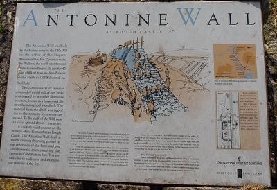
The Antonine Wall was built by the Roman army in the 140's AD on the orders of the Emperor Antoninus Pius. For 20 years or more, the Wall was the north west frontier of the Roman Empire. It ran for 40 miles (64 km) from modern Bo'ness on the Forth to Old Kilpatrick on the Clyde.
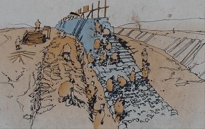
The Antonine Wall frontier consisted of a solid wall of turf, probably topped by a timber defensive structure, known as a breastwork. In front lay a deep and wide ditch. The material from the ditch was tipped out to the north to form an upcast mound. To the south of the Wall were 16 forts, spaced about 3 km apart.
If you turn round you can see the remains of the Roman fort at Rough Castle. The Antonine Wall ditch is visible crossing the rising ground on the other side of the burn and you can also see the ditches marking the east side of the Roman fort. You are welcome to walk over and examine the remains of the fort.
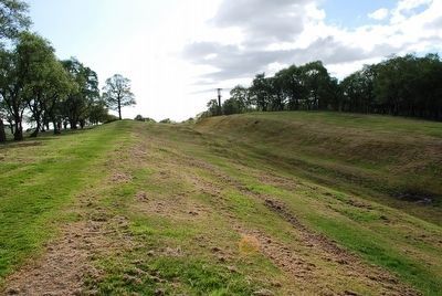
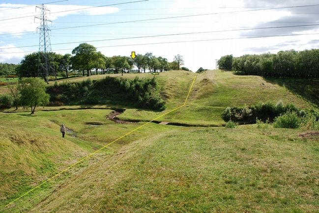
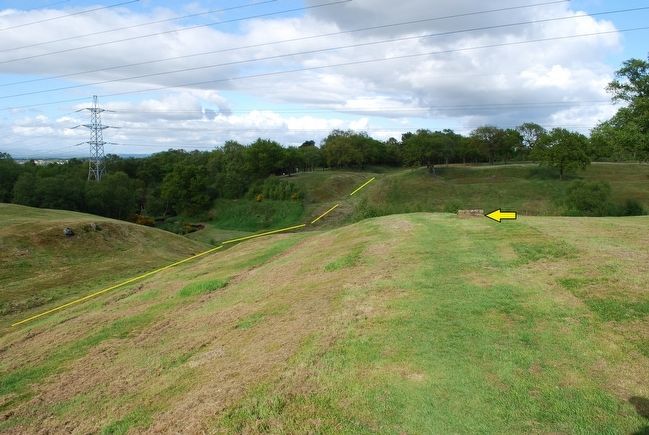
The section of the wall and ditch running to your right and across the ground in front of you is one of the best preserved along the whole-line of the Antonine Wall. The turf wall, now a grassy mound, is very well preserved close to the car park, but has been levelled as it comes closer to where you are standing.
Here you can appreciated the massive building operations undertaken by the Roman army. We believe that this turf wall would originally have been at least 3m (10ft) high. Together with the massive ditch which you can also still trace on the ground, it would have been a very effective way of controlling the entry of people into the Roman province (to your left) from outside the Empire (to your right). The turf bank of the Antonine Wall is particularly well preserved across much of the area around Rough Castle and can be followed for some distance to either east or west.
About 50 m to your left is a low grass-covered mound, all that is left of a Roman Road, the Military Way. You may have some difficulty finding this as the remains are very slight, but if you succeed you will discover that the slight bank runs back towards the car park. This road ran to the south of the Antonine Wall and connected all the forts and fortlets. This is probably the best preserved section of the Miliary Way on the whole of the Antonine Wall.
WHY WAS THE WALL BUILT?
Experts still disagree about why the Romans built this Wall. It was probably intended to mark clearly the boundary of the Roman Empire and to control the movement of the local population across this area of Britain from north to south. It was also a symbol of the power of the Roman Empire, as it was a massive monument which would have made a deep impression on the local people so many generations ago.
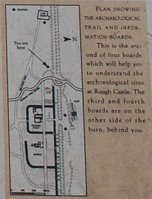
PLAN SHOWING THE ARCHAEOLOGICAL TRAIL AND INFORMATION BOARDS
This is the second of four boards which will help you to understand the archaeological sites at Rough Castle. The third and fourth boards are on the other side of the burn, behind you.
(Illustration text)
Map of Antonie Wall showing properties in Historic Scotland's care in blue.
The Wall under construction.
Topics. This historical marker is listed in these topic lists: Forts and Castles • Settlements & Settlers.
Location. 55° 59.862′ N, 3° 51.518′ W. Marker is in Falkirk, Scotland. Touch for map. Marker is in this post office area: Falkirk, Scotland FK4 2AA, United Kingdom. Touch for directions.
Other nearby markers. At least 8 other markers are within 5 kilometers of this marker, measured as the crow flies. A different marker also named The Antonine Wall (about 120 meters away, measured in a direct line); The Northern Defences (about 150 meters away); The Roman Fort (about 150 meters away); a different marker also named Antonine Wall (approx. 0.3 kilometers away); Antonine Wall Rough Castle (approx. 0.6 kilometers away); Forth & Clyde Ship Canal (approx. 1.1 kilometers away); Battle of Falkirk Muir (approx. 2.8 kilometers away); The Parish Church Graveyard (approx. 4.5 kilometers away). Touch for a list and map of all markers in Falkirk.
Credits. This page was last revised on January 27, 2022. It was originally submitted on August 5, 2015, by Brandon Fletcher of Chattanooga, Tennessee. This page has been viewed 389 times since then and 15 times this year. Photos: 1, 2, 3, 4, 5, 6. submitted on August 5, 2015, by Brandon Fletcher of Chattanooga, Tennessee. • Andrew Ruppenstein was the editor who published this page.
