Morrisburg in Stormont, Dundas and Glengarry United Counties, Ontario — Central Canada (North America)
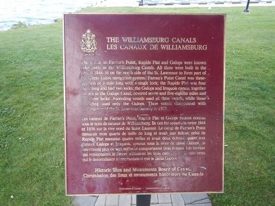
The Williamsburg Canals
The canals at Farran's Point, Rapide Plat and Galops were known collectively as the Williamsburg Canals. All three were built in the period 1844-56 on the north side of the St. Lawrence to form part of the Great Lakes navigation system. Farran's Point Canal was three-quarters of a mile long with a single lock; the Rapide Plat was four miles long and had two locks; the Galops and Iroquois canals, together known as the Galops Canal, covered seven and five-eights miles and had three locks. Ascending vessels used all three canals, while those desending used only the Galops. These canals disappeared with construction of the St. Lawrence Seaway in 1959.
Erected by Historic Sites and Monuments Board of Canada.
Topics and series. This historical marker is listed in this topic list: Waterways & Vessels. In addition, it is included in the Canada, Historic Sites and Monuments Board series list. A significant historical year for this entry is 1959.
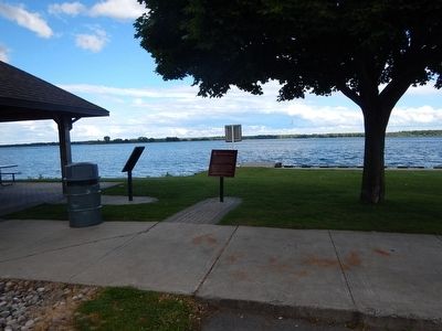
Location. 44° 53.64′ N, 75° 10.809′ W. Marker is in Morrisburg, Ontario, in Stormont, Dundas and Glengarry United Counties. Marker is located near the water in Waterfront Park. Touch for map. Marker is in this post office area: Morrisburg ON K0C 1X0, Canada. Touch for directions.
Other nearby markers. At least 8 other markers are within 5 kilometers of this marker, measured as the crow flies. W.W. II Homecoming (approx. 0.8 kilometers away); Early Power (approx. 3.7 kilometers away in the U.S.); The SS Mary (approx. 3.8 kilometers away in the U.S.); Ogden Island Mansion (approx. 3.8 kilometers away in the U.S.); George Redington House (approx. 3.8 kilometers away in the U.S.); St. Paul's Episcopal Church (approx. 3.8 kilometers away in the U.S.); Village of Waddington (approx. 3.8 kilometers away in the U.S.); In Loving Memory of Those Who Made the Supreme Sacrifice (approx. 3.9 kilometers away in the U.S.).
Also see . . . Parks Canada - The Williamsburg Canals. (Submitted on August 8, 2015, by Kevin Craft of Bedford, Quebec.)
Credits. This page was last revised on June 1, 2017. It was originally submitted on August 8, 2015, by Kevin Craft of Bedford, Quebec. This page has been viewed 324 times since then and 23 times this year. Photos: 1, 2. submitted on August 8, 2015, by Kevin Craft of Bedford, Quebec.

