Hudson Bay in Vancouver in Clark County, Washington — The American West (Northwest)
Whose Anchor?
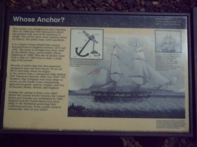
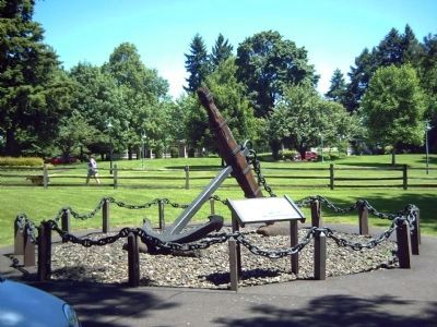
It is a Rogers Paten Small-Palm anchor, manufactured in England between 1815 and 1850. The chain is wrought iron stud, used by the British Navy, and probably others, beginning in 1808. This size of anchor came from a ship of 1,000 tons or more, a large ship of the period.
Records of which ship lost this important equipment have not been found. So we are left to speculate about its origins. Is the anchor from a commercial ship visiting Fort Vancouver between 1825 and 1850? The Hudsonís Bay Company had many ships in service on the Pacific Coast transporting agricultural goods, salmon, lumber, and furs to Russian Alaska, Hawaii, and England.
Perhaps ths anchor is from a war ship? Before the current border between the United States and Canada was established in 1846, England and the United States had naval ships in the Northwest protecting their conflicting interests. Is the anchor naval or commercial, what do you think?
Erected by National Park Service, Fort Vancouver National Historic Site, and the Vancouver National Historic Reserve.
Topics. This historical marker is listed in this topic list: Waterways & Vessels. A significant historical year for this entry is 1960.
Location. 45° 37.565′ N, 122° 39.31′ W. Marker is in Vancouver, Washington, in Clark County. It is in Hudson Bay. Marker is on E. Evergreen Boulevard, on the right when traveling east. Marker is near the Fort Vancouver Visitors Center. Touch for map. Marker is in this post office area: Vancouver WA 98661, United States of America. Touch for directions.
Other nearby markers. At least 8 other markers are within walking distance of this marker. Officers Row (within shouting distance of this marker); First Japanese on the North American Continent (about 400 feet away, measured in a direct line); U. S. Grant Memorial (about 700 feet away); The Marshall House (about 700 feet away); Pearson Airfield (about 800 feet away); Early Aviation History in Vancouver (about 800 feet away); Carlton Foster Bond (about 800 feet away); The Chkalov Transpolar Flight (approx. 0.2 miles away). Touch for a list and map of all markers in Vancouver.
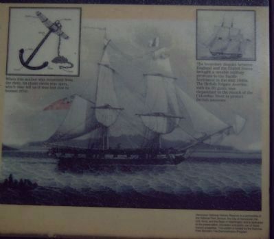
More about this marker. The picture in the upper left, as well as the main marker picture, is of the British Frigate America. The caption for both pictures is, "The boundary dispute between England and the United States brought a notable military presence to the Pacific Northwest in the mid-1840s, The British Frigate America, with its 50 guns, was dispatched to the mouth of the Columbia River to protect British interests."
The small inset picture in the upper center of the marker identifies parts of this anchor. The noted parts are the: stock, shackle, shank, Palm, crown, fluke, clevis. The caption speculates how the anchor might have come to rest on the bottom of the Columbia River. Specifically, it reads, "When this anchor was recovered from the river, its chain clevis was open, which may tell us it was lost due to human error."
The bottom left corner of the marker identifies the partnership and funding that made this display and marker possible. It reads, "Vancouver National Historic Reserve is a partnership of the National Park Service, the City of Vancouver, the U.S. Army, and the State of Washington and is dedicated to the preservation, education and public use of these historic properties. This exhibit is funded by the National Park Serviceís Fee Demonstration Program."
Credits. This page was last revised on February 7, 2023. It was originally submitted on July 1, 2008, by Kevin W. of Stafford, Virginia. This page has been viewed 2,234 times since then and 27 times this year. Photos: 1, 2, 3. submitted on July 1, 2008, by Kevin W. of Stafford, Virginia.


