Guernsey in Platte County, Wyoming — The American West (Mountains)
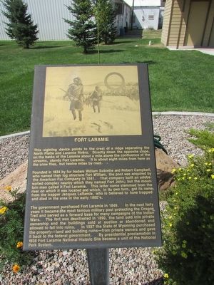
Fort Laramie
This sighting device points to the crest of a ridge separating the North Platte and Laramie Rivers. Directly down the opposite slope, on the banks of the Laramie about a mile above the confluence of the streams, stands Fort Laramie. It is about eight miles from here as the crow flies, but twelve miles by road.
Founded in 1834 by fur traders William Sublette and Robert Campbell, who named their log structure Fort William, the post was acquired by the American Fur Company in 1841. That company built an adobe-walled complex nearby which they named Fort John, but the mountain men called it Fort Laramie. This latter name stemmed from the river on which it was located and which, on its own turn, got its name from the trapper Jacques LaRamie, who is believed to have trapped and died in the area in the early 1800’s.
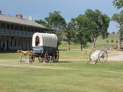
The government purchased Fort Laramie in 1849. In the next forty years it became the most famous military post protecting the Oregon Trail and served as a forward base for many campaigns of the Indian Wars. The fort was deactivated in 1890, the land sold into private ownership and the buildings sold at auction or abandoned and allowed to fall into ruins. In 1937 the State of Wyoming purchased the property – land and building ruins – from private owners and gave it back to the federal government. By presidential proclamation in 1938 Fort Laramie National Historic Site became a unit of the National Park System.
Topics. This historical marker is listed in this topic list: Forts and Castles. A significant historical year for this entry is 1834.
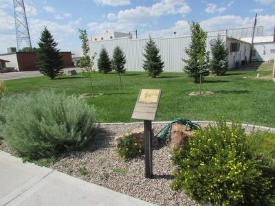
Location. 42° 16.151′ N, 104° 44.468′ W. Marker is in Guernsey, Wyoming, in Platte County. Marker is on S Wyoming Avenue, on the left when traveling south. Touch for map. Marker is in this post office area: Guernsey WY 82214, United States of America. Touch for directions.
Other nearby markers. At least 8 other markers are within walking distance of this marker. Mexican Hill (here, next to this marker); North Platte River (here, next to this marker); Guernsey Pipeline Station (here, next to this marker); Register Cliffs (here, next to this marker); Guernsey – Frederick Ranch (a few steps from this marker); Sand Point (a few steps from this marker); Laramie Peak (a few steps from this marker); The Burlington – Northern Railroad (a few steps from this marker). Touch for a list and map of all markers in Guernsey.
Credits. This page was last revised on June 16, 2016. It was originally submitted on August 9, 2015, by Bill Coughlin of Woodland Park, New Jersey. This page has been viewed 436 times since then and 8 times this year. Photos: 1, 2, 3. submitted on August 9, 2015, by Bill Coughlin of Woodland Park, New Jersey.


