Guernsey in Platte County, Wyoming — The American West (Mountains)
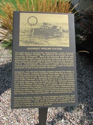
Guernsey Pipeline Station
This sight points to the Guernsey Pipeline Station, jointly owned by the Platte Pipeline Company, the American Oil Company and the Continental Oil Company. Most of the structures under view were built in 1952 although, owing to the river’s favorable grade and south-easterly course, the first pipeline through this vicinity was delivering Platte Valley petroleum wealth to mid-western urban centers as early as 1918. Technologically, this station is capable of interchanging crude oil among several carrier lines and moving it south to Cheyenne and Denver or east to mid-continent refineries.
Aborigines, from the early foraging societies through the heyday of the Plains Tribes, exploited the North Platte Valley both as a route of travel and commerce and for its own natural wealth. But fur traders, conducting most of their operations further west in the mountains, were chiefly interested in the North Platte as a route of commerce; for covered wagon immigrants the Platte was only a necessarily traveled route lying between their past and their future; for pony express, stage and telegraph enterprises it was a pathway between inhabited regions wherein they provided the connecting links; livestockmen did exploit the valley’s riches but preferred that someone else provide transportational services; railroaders found some local business but that was incidental to their basic operation – the transcontinental haul.
Petroleum concerns, however, like the aborigines before them, have existed on both the valley’s natural wealth and its transportational potentials. They have exploited its availability as a route for commerce to increase the value of its products through delivery to areas of maximum demand.
Topics. This historical marker is listed in this topic list: Industry & Commerce. A significant historical year for this entry is 1952.
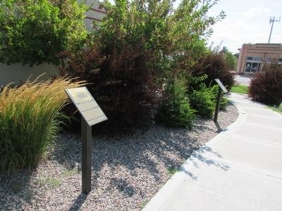
Location. 42° 16.149′ N, 104° 44.473′ W. Marker is in Guernsey, Wyoming, in Platte County. Marker is on S Wyoming Avenue, on the left when traveling south. Touch for map. Marker is in this post office area: Guernsey WY 82214, United States of America. Touch for directions.
Other nearby markers. At least 8 other markers are within walking distance of this marker. Register Cliffs (here, next to this marker); North Platte River (here, next to this marker); Guernsey – Frederick Ranch (here, next to this marker); Sand Point (here, next to this marker); Fort Laramie (here, next to this marker); Mexican Hill (here, next to this marker); Laramie Peak (a few steps from this marker); The Burlington – Northern Railroad (a few steps from this marker). Touch for a list and map of all markers in Guernsey.
Credits. This page was last revised on June 16, 2016. It was originally submitted on August 10, 2015, by Bill Coughlin of Woodland Park, New Jersey. This page has been viewed 336 times since then and 7 times this year. Photos: 1, 2. submitted on August 10, 2015, by Bill Coughlin of Woodland Park, New Jersey.

