Maitland in Leeds and Grenville United Counties, Ontario — Central Canada (North America)
Pointe Au Baril
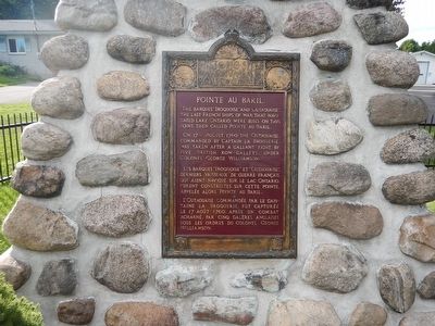
The barques "Iroquoise" and "Outaouaise", the last French ships of war that navigated Lake Ontario, were built on this point, then called Pointe Au Baril.
On 17th August, 1760, the Outaouaise, commanded by Captain La Broquerie, was taken after a gallant fight, by five British Row-Galleys, under Colonel George Williamson.
French text:
Les Barques "Iroquoise" et "Outaouaise", derniers vaisseaux de guerre Français qui aient navigué sur le lac Ontario, furent construites sur cette pointe, appelée alors Pointe Au Baril.
L'Outaouaise commandée par le Capitaine La Broquerie, fut capturée le 17 août 1760, après un combat acharné, par cinq galères Anglaise sous les ordres du Colonel George Williamson.
Erected by Historic Sites and Monuments Board of Canada.
Topics. This historical marker is listed in this topic list: Waterways & Vessels. A significant historical year for this entry is 1760.
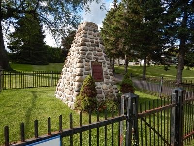
Location. 44° 38.25′ N, 75° 36.604′ W. Marker is in Maitland, Ontario, in Leeds and Grenville United Counties. Marker is on Provincial Highway 2, 0.1 kilometers west of Maitland Road, on the right when traveling west. Marker is attached to a cairn and surrounded by a low metal fence. Touch for map. Marker is at or near this postal address: 1284 Ontario Route 2, Maitland ON K6V 5T1, Canada. Touch for directions.
Other nearby markers. At least 8 other markers are within 3 kilometers of this marker, measured as the crow flies. Dorothy Martha Dumbrille (about 210 meters away, measured in a direct line); Douglas Rupert Dumbrille (about 210 meters away); St. James's Masonic Lodge No. 74 (about 240 meters away); Lieut.-Col. Thain Wendell MacDowell, V.C., D.S.O. (about 240 meters away); The Founding of Maitland (approx. 0.3 kilometers away); Dumbrille's Store (approx. 0.3 kilometers away); St. James Church 1826 (approx. 0.3 kilometers away); War of 1812 (approx. 2.2 kilometers away in the U.S.). Touch for a list and map of all markers in Maitland.
Also see . . . Parks Canada - Pointe Au Baril. (Submitted on August 11, 2015, by Kevin Craft of Bedford, Quebec.)
Credits. This page was last revised on September 27, 2019. It was originally submitted on August 11, 2015, by Kevin Craft of Bedford, Quebec. This page has been viewed 354 times since then and 32 times this year. Photos: 1, 2. submitted on August 11, 2015, by Kevin Craft of Bedford, Quebec.

