Natchez in Adams County, Mississippi — The American South (East South Central)
Bluff Park - Playground for the City
Natchez Trails
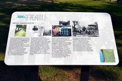
The Bluff Park has long been a center of public activity. The Marquis de Lafayette, a French hero of the American Revolution, spoke in the Bluff Park in April 1825. Citizens filled with “horror and dismay” gathered in the park for a “public demonstration of grief” at President Abraham Lincoln’s death in April 1865. In 1909, President William Howard Taft addressed a large crowd on the bluff as he traveled the Mississippi River. More recently, Vice-President George H.W. Bush spoke from the gazebo to a large crowd in 1984.
Natchez residents gather in the Bluff Park for concerts, July 4th fireworks, Easter sunrise services, and festivals like the Great Mississippi River Balloon Race. The first launch of a hot air balloon in Natchez occurred in 1806. A balloon named the Star of the West flew in 1836, and diarist William Johnson described it as “the most beautiful splendid sight ever seen in this place ....” Johnson also noted a disastrous 1842 balloon launch, which was delayed by weather and created an angry mob that destroyed the balloon. The historic photograph (above) documents a hot air balloon flight at Landsdowne Park about 1890.
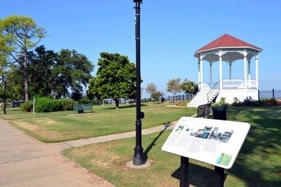
The Pilgrimage Garden Club built the bandstand in the Bluff Park in 1969 to honor the Mayor and Board of Aldermen and Katherine Grafton Miller, one of the founders and primary promoter of the Natchez Pilgrimage house tours. The existing 1960s bandstand is similar to the Victorian bandstand (pictured above). The Victorian bandstand replaced an earlier classical bandstand that appears in several drawings of the Natchez bluff.
Topics and series. This historical marker is listed in these topic lists: Air & Space • Settlements & Settlers. In addition, it is included in the Former U.S. Presidents: #27 William Howard Taft, the Lafayette’s Farewell Tour, and the Mississippi - Natchez Trails series lists. A significant historical month for this entry is April 1825.
Location. 31° 33.71′ N, 91° 24.388′ W. Marker is in Natchez, Mississippi, in Adams County. Marker can
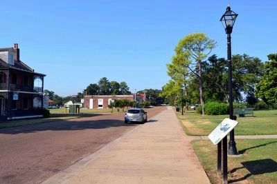
be reached from S. Broadway Street south of Main Street, on the right when traveling south. Marker is located in Bluff Park along the S. Broadway Street sidewalk. Touch for map. Marker is in this post office area: Natchez MS 39120, United States of America. Touch for directions.
Other nearby markers. At least 8 other markers are within walking distance of this marker. Spanish Colonial Natchez (here, next to this marker); Natchez (within shouting distance of this marker); Richard N. Wright (within shouting distance of this marker); Bluff Park - Memorials and Louisiana Connections (within shouting distance of this marker); The Natchez Trace (within shouting distance of this marker); Bluff Park and South Broadway Street (within shouting distance of this marker); Ealey Brothers (about 300 feet away, measured in a direct line); Intersection of Main and Canal Streets (about 400 feet away). Touch for a list and map of all markers in Natchez.
Also see . . . The Natchez Bluff. From the website of Friends of Our Riverfront Natchez. (Submitted on August 14, 2015.)
Credits. This page was last revised on June 18, 2020. It was originally submitted on August 14, 2015, by Duane Hall of Abilene, Texas. This page has been viewed 969 times since then and 58 times this year. Photos: 1, 2, 3. submitted on August 14, 2015, by Duane Hall of Abilene, Texas.


