Gering in Scotts Bluff County, Nebraska — The American Midwest (Upper Plains)
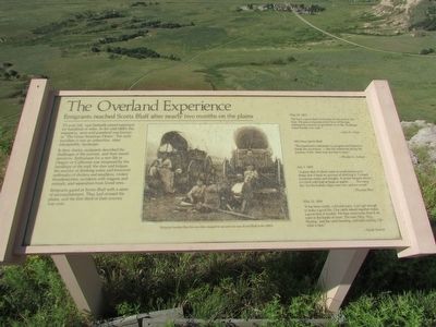
The Overland Experience
Emigrants reached Scotts Bluff after nearly two months on the plains
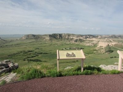
To your left, vast flatlands extend eastward – for hundreds of miles. In the mid-1800’s this expansive, semi-arid grassland was known as “The Great American Desert.” For early travelers it was an unfamiliar, often inhospitable landscape.
In their diaries, emigrants described the challenges of the journey, and their mixed emotions. Enthusiasm for a new life in Oregon or California was tempered by the hardships of the trail; the dust and fatigue; the scarcity of drinking water and firewood; outbreaks of cholera and smallpox; violent thunderstorms; accidents with wagons and animals; and separation from loved ones.
Emigrants gazed at Scotts Bluff with a sense of accomplishment. They had crossed the plains, and the first third of their journey was over.
May 29, 1852
“We have a great deal of sickness on the road at this time. We pass companies every hour of the day waiting for someone to get better or to die. Passenger trains hardly ever wait.”
1853 Near Scotts Bluff
“The landmarks indicated our progress and helped to break the monotony- like the milestones along the journey of life, there was one less to pass.”
July 1, 1853
“A great deal of alkali water in pools injurious to sheep; lost 3 head on account of drinking it. Crossed numerous creeks and sloughs. A severe tempest about 6 o’clock with hail as large as apples . . . . No campfire, for the buffalo chips were wet, and no wood.”
May 12, 1854
“It has been windy, cold and rainy. Can’t get enough to make a good fire. Our cattle mixed together makes a good deal of trouble. We hear more noise than if we were in the bustle of town. The men ‘Hoy, Hoy, Hoying,’ and the cattle bawling, and bells rattling. Oh what a time.”
Erected by National Park Service, U.S. Department of the Interior.
Topics. This historical marker is listed in these topic lists: Roads & Vehicles • Settlements & Settlers. A significant historical month for this entry is May 1846.
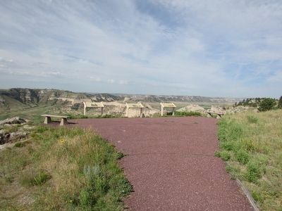
Location. Marker has been reported permanently removed. It was located near 41° 50.09′ N, 103° 41.981′ W. Marker was in Gering, Nebraska, in Scotts Bluff County. Marker could be reached from Old Oregon Trail, on the right when traveling west. Marker is located in Scotts Bluff National Monument, at the end of the South Overlook Trail at the summit of the bluff. Touch for map. Marker was in this post office area: Gering NE 69341, United States of America.
We have been informed that this sign or monument is no longer there and will not be replaced. This page is an archival view of what was.
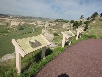
Other nearby markers. At least 8 other markers are within walking distance of this location. A Landscape Changed Forever (here, next to this marker); Before the Wagons (here, next to this marker); The Many Faces of the Trail (here, next to this marker); Remnant Highlands (within shouting distance of this marker); A Landmark for the Ages (approx. 0.2 miles away); Saddle Rock Trail (approx. 0.2 miles away); Eroding Landmark (approx. ¼ mile away); Scott Memorial (approx. ¼ mile away). Touch for a list and map of all markers in Gering.
More about this marker. A photograph in the center of the marker has a caption of “Emigrant families like this one often stopped to eat and rest near Scotts Bluff in the 1850’s.”
Credits. This page was last revised on September 14, 2020. It was originally submitted on August 17, 2015, by Bill Coughlin of Woodland Park, New Jersey. This page has been viewed 341 times since then and 6 times this year. Last updated on September 13, 2020, by Connor Olson of Kewaskum, Wisconsin. Photos: 1, 2, 3, 4. submitted on August 17, 2015, by Bill Coughlin of Woodland Park, New Jersey. • Devry Becker Jones was the editor who published this page.


