Ciudad Vieja, Sacatepéquez, Guatemala — Central America (Central Highlands)
Founding of the First Capital of Guatemala
Inscription.
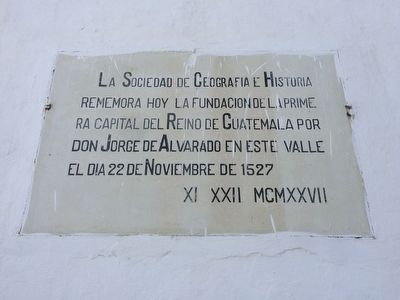
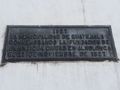
La Sociedad de Geografia e Historia rememora hoy la fundacion de la primera capital del Reino de Guatemala por Don Jorge de Alvarado en este valle el dia 22 de Noviembre de 1527
XI XXII MCMXXVII
The Geography and History Society remembers today the founding of the first capital of the Kingdom of Guatemala by Jorge de Alvarado in this valley on November 22 of 1527
XI XXII MCMXXVII (November 22, 1927)
Erected 1927.
Topics. This historical marker is listed in these topic lists: Colonial Era • Government & Politics • Settlements & Settlers. A significant historical month for this entry is November 1845.
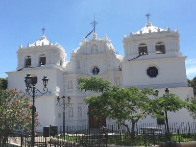
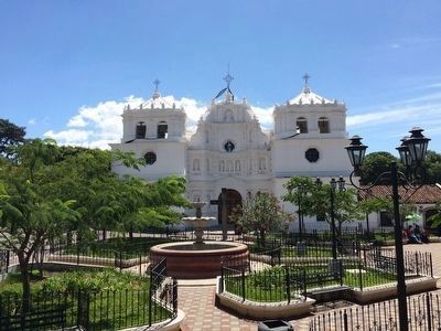
Location. 14° 31.528′ N, 90° 45.71′ W. Marker is in Ciudad Vieja, Sacatepéquez. The marker is to the left of the entrance to the Catholic Church of Ciudad Vieja. Touch for map. Marker is in this post office area: Ciudad Vieja, Sacatepéquez 03012, Guatemala. Touch for directions.
Other nearby markers. At least 8 other markers are within 5 kilometers of this marker, measured as the crow flies. Doña Beatriz de la Cueva (about 120 meters away, measured in a direct line); The Esquisuchil Medicinal Tree (Bourreria huanita) (approx. 1.1 kilometers away); Juanito Cucuy Taj (approx. 1.6 kilometers away); San Pedro las Huertas Catholic Church (approx. 2.4 kilometers away); Tragic Accident in San Antonio Aguas Calientes (approx. 3.2 kilometers away); 100th Anniversary of the Cross of San Bartolomé Becerra (approx. 3.2 kilometers away); The Church of the First Bishop of Guatemala (approx. 3.7 kilometers away); José Luis de León Diaz (approx. 3.8 kilometers away). Touch for a list and map of all markers in Ciudad Vieja.
Regarding Founding of the First Capital of Guatemala. Technically this was the second Spanish capital in Guatemala, with the original Spanish capital at Tecpán built near the Mayan city of Iximché. The actual site of this second capital was in nearby San Miguel Escobar, which is the modern name for the district that contains the actual ruins of the second colonial capital of the Guatemala region. The Spaniards founded their capital here in 1527. The city was destroyed by a catastrophic mudslide from Agua Volcano in 1541, and the survivors had no choice but to abandon the site. Among the casualties
was the governess Beatriz de la Cueva. The capital was founded for the third time several miles away at Antigua Guatemala in 1543.
Credits. This page was last revised on January 4, 2023. It was originally submitted on August 17, 2015, by J. Makali Bruton of Accra, Ghana. This page has been viewed 706 times since then and 24 times this year. Photos: 1, 2, 3, 4. submitted on August 17, 2015, by J. Makali Bruton of Accra, Ghana.


