Allatoona in Bartow County, Georgia — The American South (South Atlantic)
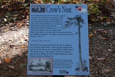
The Crow's Nest
At this approximate location stood the Crow's Nest, a sixty-foot tall Georgia Pine surmounted by a signal platform. Before and after the battle, information to General Sherman was sent by signal flag communication from this platform to signal station on Kennesaw Mountain, some 18 miles south. With the battle underway, signalmen James W. McKenzie and Frank A. West attempted to send a message while standing on top of the eastern redoubt. Using a six-foot flag on a sixteen-foot staff, the two men drew intense fire from Confederate sharpshooters. The message was finally seen from Kennesaw Mountain at 10:35 a.m.
"We hold out. General Corse here."
The Crow's Nest tree became diseased after the war and was ordered cut down by Governor Joseph M. Brown. Souvenir cigar boxes and gavels were made from the tree trunk and sent to Generals Joseph E. Johnston, Samuel G. French and John M. Corse. These mementos were also sent to Allatoona Station Master Sam W. Wilkes, the Y.M.C.A. of Boston, Massachusetts, and the Smithsonian Institute in Washington D.C.
First Lieutenant Henry Otis Dwight sketched this picture of the signal post on Kennesaw Mountain during the Battle of Allatoona Pass. It was at this post that Sherman received the message that General Corse had arrived and anxiously awaited news from the battle raging at Allatoona Pass.
Erected by Georgia State Parks & Historical Sites.
Topics. This historical marker is listed in this topic list: War, US Civil.
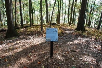
Location. 34° 7.013′ N, 84° 42.804′ W. Marker is in Allatoona, Georgia, in Bartow County. Marker can be reached from Old Alltatoona Road SE, 0.4 miles north of Allatoona Landing Road SE, on the right when traveling north. Located on the Battle of Allatoona Pass Trail. Touch for map. Marker is at or near this postal address: 632 Old Allatoona Road SE, Cartersville GA 30121, United States of America. Touch for directions.
Other nearby markers. At least 8 other markers are within walking distance of this marker. The Eastern Redoubt (about 300 feet away, measured in a direct line); Federal Trenches (about 400 feet away); The Allatoona Mountain Range (about 500 feet away); Military Service Road (about 600 feet away); 4th Minnesota Regimental Headquarters (about 800 feet away); The Deep Cut (approx. 0.2 miles away); Minnesota (approx. 0.2 miles away); Wisconsin (approx. 0.2 miles away). Touch for a list and map of all markers in Allatoona.
Credits. This page was last revised on November 27, 2018. It was originally submitted on August 18, 2015, by Brandon Fletcher of Chattanooga, Tennessee. This page has been viewed 494 times since then and 24 times this year. Photos: 1, 2. submitted on August 18, 2015, by Brandon Fletcher of Chattanooga, Tennessee. • Bernard Fisher was the editor who published this page.

