Banner in Sheridan County, Wyoming — The American West (Mountains)
The Bozeman Trail 1863 – 1868
Inscription.
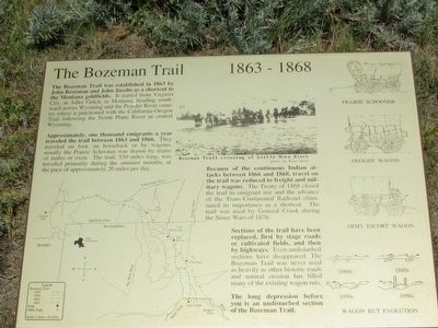
The Bozeman Trail was established in 1863 by John Bozeman and John Jacobs as a shortcut to the Montana goldfields. It started from Virginia City, at Adler Gulch, in Montana, heading southward across Wyoming and the Powder River country where it junctioned with the California-Oregon Trail following the North Platte River in central Wyoming.
Approximately, one thousand emigrants a year traveled the trail between 1863 and 1866. They traveled on foot, on horseback or by wagons, usually the Prairie Schooner was drawn by teams of mules or oxen. The trail, 530 miles long, was traveled primarily during the summer months, at the pace of approximately 20 miles per day.
Because of the continuous Indian attacks between 1866 and 1868, travel on the trail was reduced to freight and military wagons. The Treaty of 1868 closed the trail to emigrant use and the advance of the Trans-Continental Railroad eliminated its importance as a shortcut. The trail was used by General Crook during the Sioux Wars of 1876.
Sections of the trail have been replaced, first by stage roads or cultivated fields, and then by highways. Even undisturbed sections have disappeared. The Bozeman Trail was never used as heavily as other historic roads and natural erosion has filled many of the existing wagon ruts.
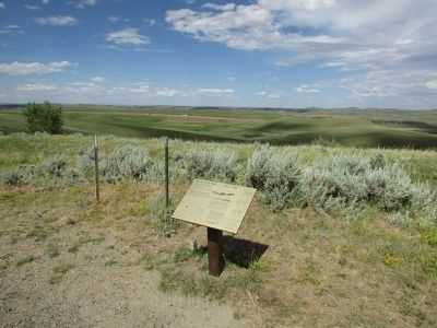
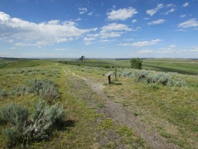
The long depression before you is an undisturbed section of the Bozeman Trail.
Topics. This historical marker is listed in these topic lists: Roads & Vehicles • Wars, US Indian. A significant historical year for this entry is 1863.
Location. 44° 34.611′ N, 106° 50.516′ W. Marker is in Banner, Wyoming, in Sheridan County. Marker can be reached from Piney Creek Road. Touch for map. Marker is in this post office area: Banner WY 82832, United States of America. Touch for directions.
Other nearby markers. At least 8 other markers are within walking distance of this marker. As an Infantryman . . . (within shouting distance of this marker); The Discoveries (about 400 feet away, measured in a direct line); During Your Advance . . . (about 500 feet away); Weapons of the Fetterman Fight (about 600 feet away); In the End . . . (about 600 feet away); As a Cavalryman . . . (about 600 feet away); As the Attack Continues… (approx. 0.2 miles away); Two Scenarios: Fetterman Fight, December 21, 1866 (approx. 0.2 miles away). Touch for a list and map of all markers in Banner.
More about this marker. A mp showing the route of the Bozeman Trail appears on the left side of the marker. Pictures of a Prairie Schooner, Freight Wagon, Army Escort Wagon and Wagon Rut Evolution are along the marker's right side. A photo at the top of the marker depicts the Bozeman Trail crossing of the Little Horn River.
Related markers. Click here for a list of markers that are related to this marker. See all of the markers on the Fetterman Fight Interpretive Trail.
Credits. This page was last revised on September 18, 2020. It was originally submitted on August 21, 2015, by Bill Coughlin of Woodland Park, New Jersey. This page has been viewed 620 times since then and 38 times this year. Photos: 1, 2, 3. submitted on August 21, 2015, by Bill Coughlin of Woodland Park, New Jersey.


