Near Sheppton in Schuylkill County, Pennsylvania — The American Northeast (Mid-Atlantic)
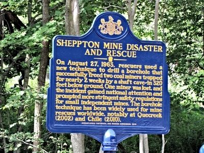
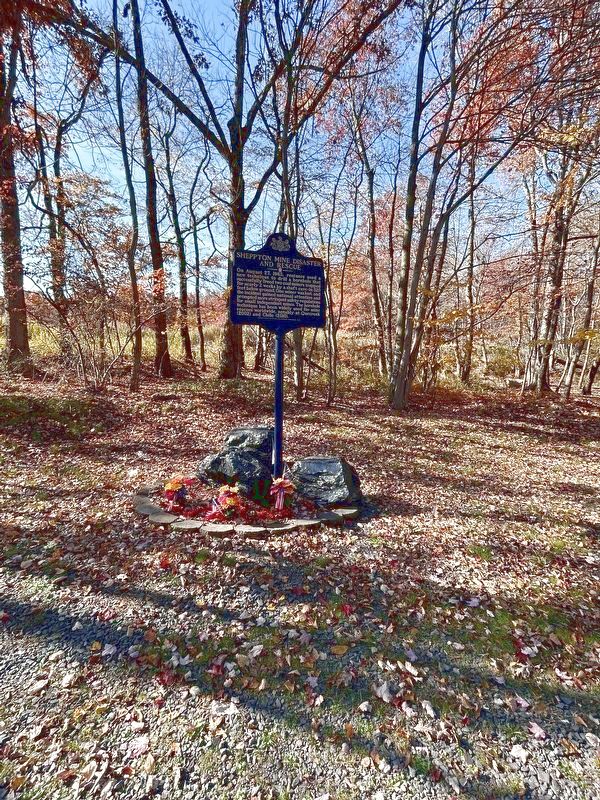
Sheppton Mine Disaster and Rescue
Erected 2015 by Pennsylvania Historical and Museum Commission.
Topics and series. This historical marker is listed in this topic list: Disasters. In addition, it is included in the Pennsylvania Historical and Museum Commission series list. A significant historical date for this entry is August 27, 1963.
Location. 40° 54.118′ N, 76° 7.432′ W. Marker is near Sheppton, Pennsylvania, in Schuylkill County. Marker is on Schoolhouse Road, ¼ mile north of Pennsylvania Route 924. Touch for map. Marker is in this post office area: Sheppton PA 18248, United States of America. Touch for directions.
Other nearby markers. At least 8 other markers are within 7 miles of this marker, measured as the crow flies. Knelly Podany Post 616 Memorial (approx. 0.4 miles away); Old White Church Cemetery (approx. 5.4 miles away); Old White Church (approx. 5.4 miles away); a different marker also named Old White Church (approx. 5.4 miles away); Frederick Löwenberg "Labenberg" (approx. 5.4 miles away); Kaier Mansion (approx. 6.1 miles away); First Congregational Church (approx. 6.1 miles away); Mahanoy City High School (approx. 6.1 miles away).
Also see . . .
1. Historical marker commemorating mine rescue unveiled in Sheppton. The RepublicanHerald.com's article (August 23, 2015) on the unveiling of the Sheppton Mine Disaster marker. {Subscription required} (Submitted on August 23, 2015.)
2. Sheppton Mine Disaster and Rescue - MarkerQuest. (Submitted on November 2, 2023, by Laura Klotz of Northampton, Pennsylvania.)
Additional commentary.
1. Remembrance
Remember Lou Bova - (1909 -1963), the sole miner lost in this disaster.
— Submitted March 11, 2016, by Mark Hilton of Montgomery, Alabama.
Credits. This page was last revised on December 2, 2023. It was originally submitted on August 22, 2015, by Carolyn Martienssen of West Hazleton, Pennsylvania. This page has been viewed 818 times since then and 44 times this year. Photos: 1. submitted on August 22, 2015, by Carolyn Martienssen of West Hazleton, Pennsylvania. 2. submitted on November 2, 2023, by Laura Klotz of Northampton, Pennsylvania. • Bill Pfingsten was the editor who published this page.

