Marker Logo HMdb.org THE HISTORICAL
MARKER DATABASE
“Bite-Size Bits of Local, National, and Global History”
Near Oneida in Clay County, Kentucky — The American South (East South Central)
 

Chief Red Bird


Chief Red Bird Marker image. Click for full size.
Photographed By Duane Hall, August 6, 2015
1. Chief Red Bird Marker
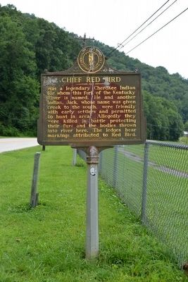
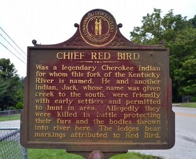
Inscription. Was a legendary Cherokee Indian for whom this fork of the Kentucky River is named. He and another Indian, Jack, whose name was given creek to the south, were friendly with early settlers and permitted to hunt in area. Allegedly they were killed in battle protecting their furs and the bodies thrown into river here. The ledges bear markings attributed to Red Bird.
 
Erected 1966 by Kentucky Historical Society and Kentucky Department of Highways. (Marker Number 908.)
 
Topics and series. This historical marker is listed in these topic lists: Native AmericansWaterways & Vessels. In addition, it is included in the Kentucky Historical Society series list.
 
Location. 37° 10.298′ N, 83° 34.981′ W. Marker is near Oneida, Kentucky, in Clay County. Marker is on State Highway 66, 0.6 miles north of U.S. 421, on the right when traveling south. Touch for map. Marker is at or near this postal address: 523 Kentucky 66, Oneida KY 40972, United States of America. Touch for directions.
 
Other nearby markers. At least 8 other markers are within 10 miles of this marker, measured as the crow flies. John Gilbert, Sr. Memorial Highway (a few steps from this marker); Oneida Baptist Institute (approx. 7.6 miles away); County Named, 1806 (approx. 10 miles away); Salt Works was located along the old Warrior's Path
Paid Advertisement
Click on the ad for more information.
Please report objectionable advertising to the Editor.
Click or scan to see
this page online
(approx. 10 miles away); This Site is Birth Place of Local History (approx. 10 miles away); Gov. Bert T. Combs (1959-1963)/Bert T. Combs (1911 – 1991) (approx. 10 miles away); Goose Creek Salt Works (approx. 10 miles away); A Masterful Retreat (approx. 10 miles away). Touch for a list and map of all markers in Oneida.
 
Chief Red Bird Marker image. Click for full size.
Photographed By Duane Hall, August 6, 2015
2. Chief Red Bird Marker
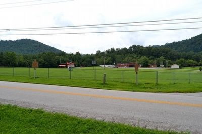
Markers in front of Big Creek Elementary School image. Click for full size.
Photographed By Duane Hall, August 6, 2015
3. Markers in front of Big Creek Elementary School
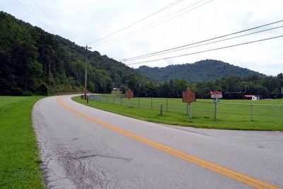
View to Southeast on Highway 66 image. Click for full size.
Photographed By Duane Hall, August 6, 2015
4. View to Southeast on Highway 66
Markers on right (south) side of highway
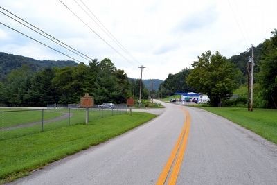
View to Northwest on Highway 66 image. Click for full size.
Photographed By Duane Hall, August 6, 2015
5. View to Northwest on Highway 66
Markers near driveway entrance to Big Creek Elementary School
 
 
Credits. This page was last revised on June 16, 2016. It was originally submitted on August 23, 2015, by Duane Hall of Abilene, Texas. This page has been viewed 2,616 times since then and 161 times this year. Photos:   1, 2, 3, 4, 5. submitted on August 23, 2015, by Duane Hall of Abilene, Texas.
Share this page.  
Share on Tumblr
m=87567

CeraNet Cloud Computing sponsors the Historical Marker Database.
This website earns income from purchases you make after using our links to Amazon.com. We appreciate your support.
Paid Advertisement
Apr. 25, 2024