Westland in Wayne County, Michigan — The American Midwest (Great Lakes)
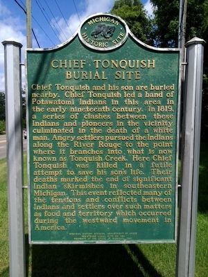
Chief Tonquish Burial Site
Erected 1977 by Michigan History Division, Department of State. (Marker Number L426.)
Topics and series. This historical marker is listed in these topic lists: Native Americans • Settlements & Settlers. In addition, it is included in the Michigan Historical Commission series list. A significant historical year for this entry is 1819.
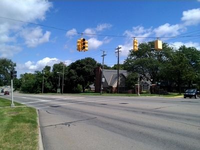
Location. 42° 21.069′ N, 83° 23.146′ W. Marker is in Westland, Michigan, in Wayne County. Marker is at the intersection of North Wayne Road and Fountain Boulevard, on the right when traveling north on North Wayne Road. Fountain Boulevard is the entrance road to the Holiday Park townhouses, which is 0.4 miles south of Ann Arbor Trail. Touch for map. Marker is at or near this postal address: 34850 Fountain Boulevard, Westland MI 48185, United States of America. Touch for directions.
Other nearby markers. At least 8 other markers are within 2 miles of this marker, measured as the crow flies. "Learning by Doing" (approx. 0.7 miles away); Nankin Millers House (approx. 0.8 miles away); Nankin Mills (approx. 0.8 miles away); a different marker also named Nankin Mills (approx. 0.8 miles away); Newburgh Cemetery (approx. 0.8 miles away); Newburg Methodist Church (approx. 1.1 miles away); Newburgh Mill (approx. 1.7 miles away); Perrinsville School (approx. 1.7 miles away). Touch for a list and map of all markers in Westland.
Also see . . . Chief Tonquish. Find A Grave website entry (Submitted on November 25, 2023, by Larry Gertner of New York, New York.)
Credits. This page was last revised on November 26, 2023. It was originally submitted on August 25, 2015, by Joel Seewald of Madison Heights, Michigan. This page has been viewed 1,652 times since then and 200 times this year. Photos: 1, 2. submitted on August 25, 2015, by Joel Seewald of Madison Heights, Michigan.

