Banner in Sheridan County, Wyoming — The American West (Mountains)
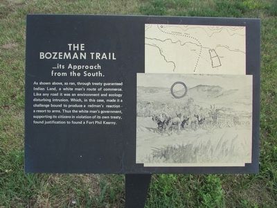
The Bozeman Trail
. . . its Approach from the South.
As shown above, so ran, through treaty guaranteed Indian Land, a white manís route of commerce. Like any road it was an environment and ecology disturbing intrusion. Which, in this case, made it a challenge bound to produce a redmanís reaction – a resort to arms. Thus the white manís government, supporting its citizens in violation of its own treaty, found justification to found a Fort Phil Kearny.
Topics. This historical marker is listed in these topic lists: Forts and Castles • Roads & Vehicles • Settlements & Settlers.
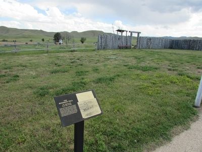
Location. 44° 31.971′ N, 106° 49.635′ W. Marker is in Banner, Wyoming, in Sheridan County. Marker is on Wagon Box Road, on the left when traveling west. Marker is located at Fort Phil Kearny. Touch for map. Marker is in this post office area: Banner WY 82832, United States of America. Touch for directions.
Other nearby markers. At least 8 other markers are within walking distance of this marker. Cemetery Site (here, next to this marker); Pilot Hill (a few steps from this marker); Fort Phil Kearny (a few steps from this marker); The Fort Kearny Sawmills (within shouting distance of this marker); A monument Honoring John ďPortugeeĒ Phillips (within shouting distance of this marker); Touring the Fort (within shouting distance of this marker); Site of a Sawmill (within shouting distance of this marker); Protecting the Travelers or the Garrison? (within shouting distance of this marker). Touch for a list and map of all markers in Banner.
More about this marker. The upper right of the marker contains a map showing the Bozeman Trail and its route past Fort Phil Kearny. Below this is a picture of a train of horse drawn wagons.
Also see . . . Fort Phil Kearny State Historic Site. (Submitted on August 25, 2015, by Bill Coughlin of Woodland Park, New Jersey.)
Credits. This page was last revised on June 16, 2016. It was originally submitted on August 25, 2015, by Bill Coughlin of Woodland Park, New Jersey. This page has been viewed 366 times since then and 17 times this year. Photos: 1, 2, 3, 4. submitted on August 25, 2015, by Bill Coughlin of Woodland Park, New Jersey.


