Lewellen in Garden County, Nebraska — The American Midwest (Upper Plains)
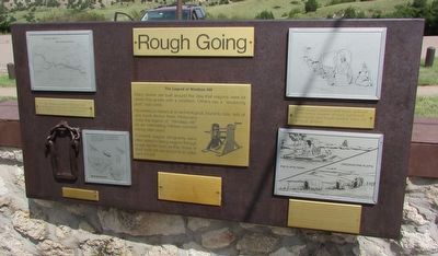
Rough Going
The Way West -- The Oregon Trail
For the wagon-traveler, the road from Independence, Missouri, to the Far West was “2,000 miles, one step at a time.”
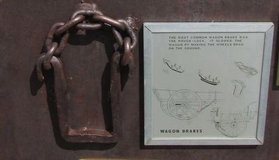
Wagon Brakes
The most common wagon brake was the rough-lock. It slowed the wagon by making the wheels drag on the ground.
Uphill travel could be still more difficult. Sometimes wagon drivers lightened their loads and made double trips on difficult grades.
No evidence, historical or archeological, found to date tells of any such device here. Historians class the legend of “Windlass Hill” as an interesting folktale created during later years.
Covered wagon emigrants were often skilled in taking wagons through rough terrain such as this. Some of their methods are shown in an adjacent exhibit.
Wagon breaks were inadequate for hills such as this, and for the many steeper grades further west. Faced with such slopes, wagon drivers locked the wheels with various devices and sometimes had all available hands hold back on ropes attached to the wagon.
Stream crossings posed the worst hazard for the wagon traveler. Further upstream the North Platte had to be crossed several places. Along the trails, crude ferries and log-rafts served the traveler until a few bridges were built by traders.
Far more emigrants, freighters and soldiers were drowned attempting river crossings than were killed by hostile Indians.
Topics. This historical marker is listed in this topic list: Roads & Vehicles.
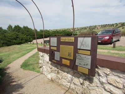
Location. 41° 15.786′ N, 102° 6.848′ W. Marker is in Lewellen, Nebraska, in Garden County. Marker can be reached from U.S. 26, on the right when traveling south. Marker is located in the Windlass Hill section of Ash Hollow State Historical Park. Touch for map. Marker is in this post office area: Lewellen NE 69147, United States of America. Touch for directions.
Other nearby markers. At least 8 other markers are within 2 miles of this marker, measured as the crow flies. Wagons in the West (here, next to this marker); Wagon Ruts (within shouting distance of this marker); Oregon Trail (about 700 feet away, measured in a direct line); Descent of Windlass Hill (approx. 0.2 miles away); a different marker also named The Oregon Trail (approx. 0.2 miles away); a different marker also named Oregon Trail (approx. 0.3 miles away); Windlass Hill Pioneer Homestead (approx. 1˝ miles away); School District 55 (approx. 1.6 miles away). Touch for a list and map of all markers in Lewellen.
More about this marker. A map on the upper left of the marker shows the routes of the Mormon, Oregon and California Trails. Below this is an illustration of how wagon brakes operated. A sample wagon brake is on the marker next to this illustration. A picture of travelers lightening their load by removing items from their wagon appears on the right side of the marker. Below this is a picture showing emigrants crossing the Platte River using the Platte Ferry and by fording the river.
Credits. This page was last revised on June 16, 2016. It was originally submitted on August 26, 2015, by Bill Coughlin of Woodland Park, New Jersey. This page has been viewed 431 times since then and 5 times this year. Photos: 1, 2, 3, 4, 5. submitted on August 26, 2015, by Bill Coughlin of Woodland Park, New Jersey.
