Medora in Billings County, North Dakota — The American Midwest (Upper Plains)
Bad Lands Cantonment
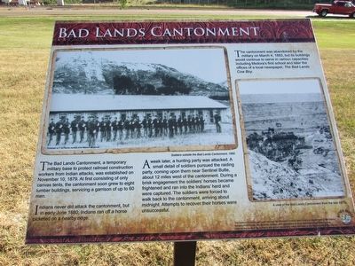
The Bad Lands Cantonment, a temporary military base to protect railroad construction workers from Indian attacks, was established on November 10, 1879. At first consisting of only canvas tents, the cantonment soon grew to eight lumber buildings, servicing a garrison of up to 60 men.
Indians never did attack the cantonment, but in early June 1880, Indians ran off a horse picketed on a nearby ridge.
A week later, a hunting party was attacked. A small detail of soldiers pursued the raiding party, coming upon them near Sentinel Butte, about 12 miles west of the cantonment. During a brisk engagement the soldiers’ horses became frightened and ran into the Indians’ herd and were captured. The soldiers were forced to walk back to the cantonment, arriving about midnight. Attempts to recover their horses were unsuccessful.
The cantonment was abandoned by the military on March 4, 1883, but its buildings would continue to serve in various capacities including Medora’s first school and later the offices of a local newspaper, The Bad Lands Cow Boy.
(Marker Number 2.)
Topics. This historical marker is listed in this topic list: Military. A significant historical date for this entry is November 10, 1879.
Location. 46° 55.056′ N, 103° 31.998′ W. Marker is in Medora, North Dakota, in Billings County. Marker is on Pacific Avenue, on the right when traveling west. The marker is located just west of the Little Missouri River. Touch for map. Marker is in this post office area: Medora ND 58645, United States of America. Touch for directions.
Other nearby markers. At least 8 other markers are within walking distance of this marker. Little Missouri: The Town (here, next to this marker); Medora Cemetery (here, next to this marker); Frontier Military (here, next to this marker); Little Missouri Bridge (here, next to this marker); Chateau de Mores (within shouting distance of this marker); De Mores Packing Plant (approx. ¼ mile away); Dreams of a Cattle Empire (approx. ¼ mile away); Loading Dock (approx. 0.3 miles away). Touch for a list and map of all markers in Medora.
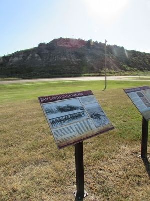
More about this marker. A photograph of “Soldiers outside the Bad Lands Cantonment, 1880” appears at the top left of the marker. The lower right of the marker contains a photo depicting “A view of the Bad Lands Cantonment from the late 1870s.”
Credits. This page was last revised on June 16, 2016. It was originally submitted on August 28, 2015, by Bill Coughlin of Woodland Park, New Jersey. This page has been viewed 681 times since then and 213 times this year. Photos: 1, 2, 3. submitted on August 28, 2015, by Bill Coughlin of Woodland Park, New Jersey.


