Manchester in Clay County, Kentucky — The American South (East South Central)
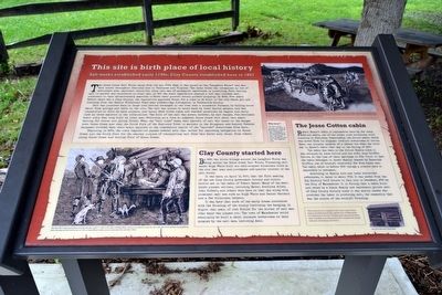
This Site is Birth Place of Local History
Salt works established early 1790s; Clay County established here in 1807
The Goose Creek Salt Works dates from the mid 1790s when it was known as the “Langford Works” and was well known throughout Kentucky and in Tennessee and Virginia. The local works was recognized as one of Kentucky’s most important industries since salt was of paramount importance in preserving food. Getting salt to market was considered so vital that in 1801 the state legislature enacted a law that allowed salt producers to take extraordinary measures to move their product across private property. In 1802, five years before there was a Clay County, the legislature approved funds for a road to be built to the site where you are standing from the famous Wilderness Road near present-day Livingston, in Rockcastle County.
Salt was produced here in large iron kettles arranged in two rows over a stonework furnace, by boiling brine water from springs and wells on the site. The salt was stored in casks made by local barrel makers, and was transported at first by pack animals, and later, when crude roads and weather permitted, by wagons and carts such as those depicted in the illustration. The bulk of the salt was moved, however, by salt barges, flat-bottomed boats sixty feet long built by local men. Obviously, as a look at adjacent Goose Creek will show, this meant waiting for winter and spring floods. When the “salt tides” came, vast amounts of salt was taken on the barges down Goose Creek and then the South Fork of the Kentucky River to markets in the Bluegrass and beyond. Several bargemen drowned when their boats capsized in the treacherous rapids of the “narrows” downstream from here.
Beginning in 1809, the state legislature passed several acts that called for improving navigation on Goose Creek and the South Fork for the express purpose of transporting salt from this works and, later, from others along Goose Creek and Collins Fork of Goose Creek.
Why here?
The salt works, county, and City of Manchester started here because of their proximity to the Warrior’s Path that ran along Goose Creek at this site. See adjacent sign.
Clay County started here
By 1806 the little village around the Langford Works was being called the Goose Creek Salt Works. Pioneering salt maker Hugh White built his well-stocked wilderness store at the site that year and purchased one-quarter interest in the salt works.
It was here, on April 13, 1807, that the first meeting of the new Clay County government (county and circuit courts) met in the cabin of Robert Baker. Many of the best-known pioneer settlers, including Baker, Adoniram Allen, John Gilbert, and others were here on that day along with prominent salt men such as Hugh White and Daniel Garrard and a few wilderness lawyers.
It was here that much of the early drama associated with the founding of the county (including the hanging, in August that year, of Joel Elkins for the murder of salt man John Amis) was played out. The town of Manchester would eventually be built a short distance downstream on land donated by the salt men, including Amis.
The Jesse Cotton Cabin
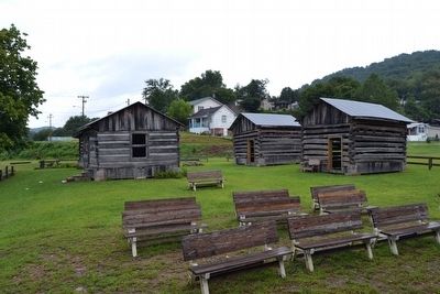
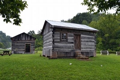
Robert Baker’s cabin is represented here by the Jesse Cotton cabin, one of the oldest such structures still standing in Kentucky. Remarkably, the Cotton cabin, which was moved from its original location downstream at Cotton Bend, was already upwards of a decade old when the court met in Baker’s cabin that day in the Spring of 1807.
The cabin has been in the Cotton family since it was occupied by Jesse Cotton and his wife, Jane Griffin Cotton, at the time of their marriage in 1812. Prior to that the cabin belonged to Jane’s family, headed by Zakariah Griffin, one of county’s relatively few free black men. The cabin dates to before 1800 though a precise date is impossible to document.
According to family lore and local historical references, it dates to about 1792. It was moved from the Big Hickory Golf Course to
this site in December, 2010 by the City of Manchester. It is fitting that a cabin built and owned by a black family now represents ground zero of Clay County history since it was mostly slaves who provided the labor in producing salt, the commodity that was the source of the county’s founding.
This historical site is a project of the Clay County Genealogical and Historical Society and the City of Manchester. It is dedicated to all Clay Countians past, present and future and is intended as an educational tool to acquaint our people with their rich heritage and history.
(Upper Right Illustration Caption)
Salt customers waiting to load the valuable cargo. At first salt was transported by pack animals, then by carts and wagons when trails were improved and roads built. When winter and spring “salt tides” allowed, the salt barrels were transported by flat-bottomed barges sixty feet long. Several bargemen lost their lives at the “narrows” of the South Fork of the Kentucky River downstream from here as the raging flood waters capsized the huge boats.
(Lower Left Illustration Caption)
The first Clay County government meeting took place April 13, 1807 at the cabin of Robert Baker, which was located at or near the salt works. The lively meeting was attended by fancy-dressing salt men and lawyers as well
as rough pioneer settlers such as Adoniram Allen and John Gilbert.
Topics. This historical marker is listed in these topic lists: Industry & Commerce • Settlements & Settlers • Waterways & Vessels. A significant historical year for this entry is 1792.
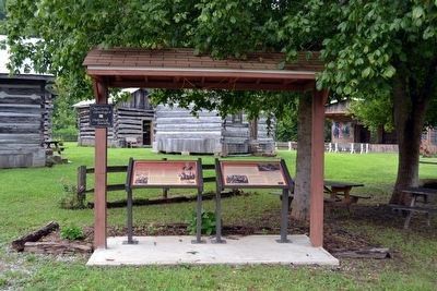
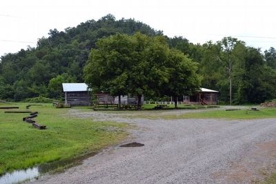
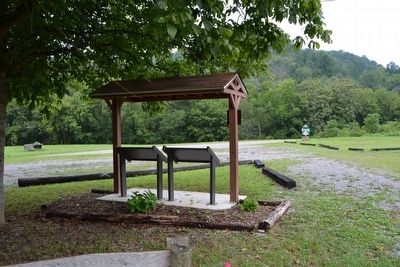
Location. 37° 8.767′ N, 83° 45.667′ W. Marker is in Manchester, Kentucky, in Clay County. Marker can be reached from Railroad Avenue south of Poplar Street, on the right when traveling south. Marker is at the south end of Riverside Park next to the Goose Creek Salt Works Pioneer Village; the above directions are to the driveway entrance to the park. Touch for map. Marker is in this post office area: Manchester KY 40962, United States of America. Touch for directions.
Other nearby markers. At least 8 other markers are within 11 miles of this marker, measured as the crow flies. Salt Works was located along the old Warrior's Path (here, next to this marker); Gov. Bert T. Combs (1959-1963)/Bert T. Combs (1911 – 1991) (approx. half a mile away); County Named, 1806 (approx. 0.6 miles away); Goose Creek Salt Works (approx. 1.7 miles away); A Masterful Retreat (approx. 1.7 miles away); Chief Red Bird (approx. 10 miles away); John Gilbert, Sr. Memorial Highway (approx. 10 miles away); Oneida Baptist Institute (approx. 10½ miles away). Touch for a list and map of all markers in Manchester.
Also see . . . Historic Goose Creek Salt Works Pioneer Village. Clay County Genealogical & Historical Society website entry (Submitted on March 28, 2022, by Larry Gertner of New York, New York.)
Credits. This page was last revised on March 28, 2022. It was originally submitted on August 29, 2015, by Duane Hall of Abilene, Texas. This page has been viewed 829 times since then and 69 times this year. Photos: 1, 2, 3, 4, 5, 6. submitted on August 29, 2015, by Duane Hall of Abilene, Texas.
