Near Tule Lake in Siskiyou County, California — The American West (Pacific Coastal)
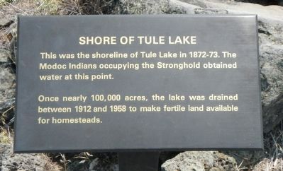
Shore of Tule Lake
Once nearly 100,000 acres, the lake was drained between 1912 and 1958 to make fertile land available for homesteads.
Topics. This historical marker is listed in these topic lists: Natural Features • Wars, US Indian. A significant historical year for this entry is 1912.
Location. 41° 49.478′ N, 121° 30.025′ W. Marker is near Tule Lake, California, in Siskiyou County. Marker can be reached from County Route 120 near Hill Road (County Route 10), on the left when traveling west. Touch for map. Marker is in this post office area: Tulelake CA 96134, United States of America. Touch for directions.
Other nearby markers. At least 8 other markers are within 3 miles of this marker, measured as the crow flies. Lava Fortress (a few steps from this marker); The Road to the Stronghold (a few steps from this marker); Attack at Hospital Rock (approx. 1.6 miles away); Last Meeting of the Peace Commission (approx. 2.3 miles away); Canby Cross (approx. 2.3 miles away); Attracted to Water (approx. 2.8 miles away); War in the Lava Beds (approx. 2.9 miles away); Modoc War Casualties (approx. 2.9 miles away). Touch for a list and map of all markers in Tule Lake.
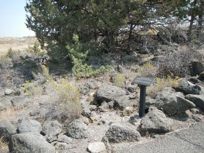
More about this marker. This marker is located near the trailhead to Captain Jack's Stronghold.
Additional keywords. Modoc War
Credits. This page was last revised on June 16, 2016. It was originally submitted on August 30, 2015, by Barry Swackhamer of Brentwood, California. This page has been viewed 398 times since then and 27 times this year. Photos: 1, 2, 3. submitted on August 30, 2015, by Barry Swackhamer of Brentwood, California.


