Niagara Falls in Niagara County, New York — The American Northeast (Mid-Atlantic)
The Niagara Portage
The Niagara Portage.
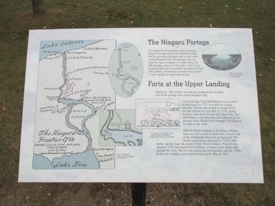
For thousands of years the seven-mile-long Niagara Portage linked Lake Ontario to Lake Erie by providing travelers with a land route around Niagara Falls. The portage trail ran from the Upper Landing, 1.5 miles above the falls (looking upriver to your left) to the Lower Landing below the Escarpment (Lewiston). In the 18th century, Europeans converted the trail into a road capable of supporing oxcarts. Niagara River looking towards Lake Ontario, ca. 1868 postcard.
Forts at the Upper Landing.
During the 18th century, several forts protected the southern end of the portage road around Niagara Falls.
Fort du Portage (Fort Little Niagara) was erected by the French in 1751 to protect fur trading interests. The fort was located 1.5 miles above hte falls (upriver on your left). In 1759, during the final years of the French and Indian War, Fort Little Niagara was evacuated and destroyed by its garrison when British forces besieged Fort Niagara 1.5 miles to the north.
With the British conquest of the Niagara Region, there was still a need to protect the southern end of the strategically important portage road. The British constructed a new post in 1760 a little father upriver (near the present Power Project intakes). This fort was rebuilt it 1763 and named Fort Schlosser, in honor of the officer who directed the work. The fort was garrisoned intermittently until the 1790s. Its last few buildings were destroyed during the War of 1812.
Fort Schlosser as enlarged in 1763. Courtesy Public Records Office, Jeffery Amherst Papers, Great Britain.
Map of the Niagara region in mid-18th century by M.N.Works.
Topics. This historical marker is listed in these topic lists: Forts and Castles • War of 1812 • War, French and Indian • Waterways & Vessels. A significant historical year for this entry is 1751.
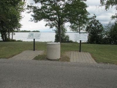
Location. 43° 4.745′ N, 79° 3.64′ W. Marker is in Niagara Falls, New York, in Niagara County. Marker is on Goat Island Road, on the right when traveling north. Marker is at the east end of Goat Island in Niagara Falls State Park. Touch for map. Marker is in this post office area: Niagara Falls NY 14303, United States of America. Touch for directions.
Other nearby markers. At least 8 other markers are within walking distance of this marker. The Parting of the Waters (here, next to this marker); Whitney Mansion (approx. 0.2 miles away); Goat Island Flora (approx. ¼ mile away); Three Sisters Islands (approx. ¼ mile away); Site of First House (approx. 0.3 miles away); The Power of the American Rapids (approx. 0.4 miles away); The Boundary Waters Treaty (approx. 0.4 miles away); Protecting Our Shared Waters (approx. 0.4 miles away). Touch for a list and map of all markers in Niagara Falls.
Credits. This page was last revised on June 16, 2016. It was originally submitted on August 30, 2015, by Anton Schwarzmueller of Wilson, New York. This page has been viewed 1,131 times since then and 94 times this year. Photos: 1, 2, 3, 4. submitted on August 30, 2015, by Anton Schwarzmueller of Wilson, New York.


