Near Worden in Klamath County, Oregon — The American West (Northwest)
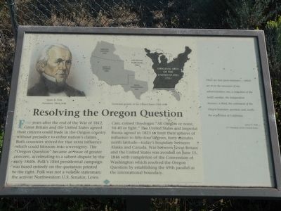
Resolving the Oregon Question
There are four great measures... which are to be measures of my administration: one, a reduction of the tariff; another, the independent treasury; a third, the settlement of the Oregon boundary question; and, lastly, the acquisition of California. - James K. Polk, 11th President of the United States.
Topics. This historical marker is listed in this topic list: Political Subdivisions. A significant historical date for this entry is June 15, 1846.
Location. 42° 0.201′ N, 121° 53.393′ W. Marker is near Worden, Oregon, in Klamath County. Marker can be reached from U.S. 97, on the right when traveling south. Touch for map. Marker is at or near this postal address: 24800 US Highway 97, Klamath Falls OR 97601, United States of America. Touch for directions.
Other nearby markers. At least 8 other markers are within 9 miles of this marker, measured as the crow flies. The 42nd Parallel (a few steps from this marker); Western International History (a few steps from this marker); Applegate Trail (a few steps from this marker); a different marker also named Applegate Trail (about 400 feet away, measured in a direct line); Dorris Veterans Memorial (approx. 3.1 miles away in California); South Road - Hot Creek (approx. 5.1 miles away in California); Picard California (approx. 5.1 miles away in California); Bear Valley (approx. 8.6 miles away). Touch for a list and map of all markers in Worden.
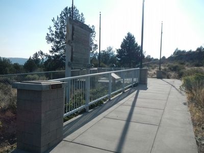
More about this marker. This marker is located at the Francis C. Landrum Historic Wayside.
Also see . . .
1. Oregon boundary dispute - Wikipedia. Expansionist competition into the region began in the 18th century, with participants including the
Russian Empire, the United Kingdom of Great Britain and Ireland, the Kingdom of Spain and the United States of America. By the 1820s, both the Russians, through the Russo-American Treaty of 1824 and the Russo-British Treaty of 1825 and the Spanish, by the Adams Onis Treaty of 1819, formally withdrew their territorial pretensions and efforts at establishing colonies in the region. Through these treaties the British and Americans gained residual territorial claims in the disputed area. (Submitted on August 31, 2015, by Barry Swackhamer of Brentwood, California.)
2. Oregon Border Dispute 1846 - Road to Confederation. An earlier treaty had established the border between Canada and the United States at the 49th parallel, but only to the Rocky Mountains. West of the Rockies was undefined and jointly occupied by British and Americans. During the mid-1800s, however, the Pacific region border came under dispute. More Americans were settling in the area, known as Oregon Country. (Submitted on August 31, 2015, by Barry Swackhamer of Brentwood, California.)
Credits. This page was last revised on June 16, 2016. It was originally submitted on August 31, 2015, by Barry Swackhamer of Brentwood, California. This page has been viewed 363 times since then and 16 times this year. Photos: 1, 2. submitted on August 31, 2015, by Barry Swackhamer of Brentwood, California.

