East Montpelier in Washington County, Vermont — The American Northeast (New England)
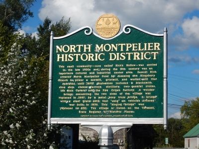
North Montpelier Historic District
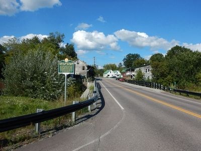
This small community – once called Rich's Hollow – was settled in the late 1700s and during the 19th century was an important cultural and industrial center area. Samuel Rich created North Montpelier Pond by damming the Kingsbury Branch to power a sawmill, gristmill, and woolen mill that operated until 1970. Businesses included a blacksmith, shoe shop, cheese factory, distillery, two general stores, the Rich Tavern and the Nye Organ factory. A wooden bridge connecting the two sides of the village was replaced in 1897 by a metal pony truss bridge. A bridge with a steel grate deck that "sang" as vehicles crossed was built in 1936. This "singing bridge" was replaced in 2011. The village is listed on the Vermont State Register of Historic Places.
Erected 2012 by Vermont Division for Historic Preservation.
Topics. This historical marker is listed in these topic lists: Bridges & Viaducts • Industry & Commerce • Settlements & Settlers.
Location. 44° 18.183′ N, 72° 26.847′ W. Marker is in East Montpelier, Vermont, in Washington County. Marker is at the intersection of Vermont Route 14 and Factory Street, on the right when traveling south on State Route 14. Touch for map. Marker is in this post office area: East Montpelier VT 05651, United States of America. Touch for directions.
Other nearby markers. At least 8 other markers are within 7 miles of this marker, measured as the crow flies. Clarence W. Fitch (approx. 3.3 miles away); Historic Kent Tavern (approx. 4.9 miles away); Montpelier Recreation Field (approx. 6.4 miles away); Senator William Upham (approx. 6.8 miles away); Site of the Caldwell House (approx. 7 miles away); The Arthur Tandy (approx. 7.1 miles away); Railroad Turntable, circa 1907 (approx. 7.1 miles away); Winooski River From Bailey’s Grain Tower, 1929 (approx. 7.1 miles away).
Credits. This page was last revised on June 16, 2016. It was originally submitted on September 1, 2015, by Kevin Craft of Bedford, Quebec. This page has been viewed 600 times since then and 52 times this year. Photos: 1, 2. submitted on September 1, 2015, by Kevin Craft of Bedford, Quebec.

