Near Keno in Klamath County, Oregon — The American West (Northwest)
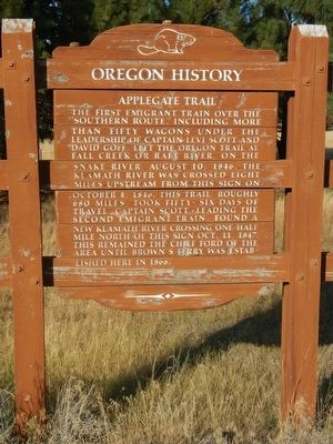
Applegate Trail
Topics and series. This historical marker is listed in these topic lists: Roads & Vehicles • Settlements & Settlers. In addition, it is included in the Applegate Trail, and the Oregon Beaver Boards series lists. A significant historical date for this entry is August 10, 1846.
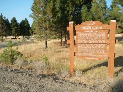
Location. 42° 8.19′ N, 122° 1.734′ W. Marker is near Keno, Oregon, in Klamath County. Marker is at the intersection of Green Springs Highway (Oregon Route 66 at milepost 44) and Toby Grade Road, on the right when traveling west on Green Springs Highway. Touch for map. Marker is in this post office area: Keno OR 97627, United States of America. Touch for directions.
Other nearby markers. At least 8 other markers are within 4 miles of this marker, measured as the crow flies. Klamath River Crossing (about 400 feet away, measured in a direct line); a different marker also named The Applegate Trail (about 400 feet away); Topsy Grade (about 400 feet away); Chase Stage Station (approx. 0.8 miles away); Second Klamath River Ford (approx. 1.1 miles away); Spencer Creek Crossing / Camp Day (approx. 1.1 miles away); Cooper Stage - Station Site (approx. 3.1 miles away); Bear Valley (approx. 3.2 miles away). Touch for a list and map of all markers in Keno.
Credits. This page was last revised on February 11, 2018. It was originally submitted on September 1, 2015, by Barry Swackhamer of Brentwood, California. This page has been viewed 491 times since then and 31 times this year. Photos: 1, 2. submitted on September 1, 2015, by Barry Swackhamer of Brentwood, California.

