Mammoth in Yellowstone National Park in Park County, Wyoming — The American West (Mountains)
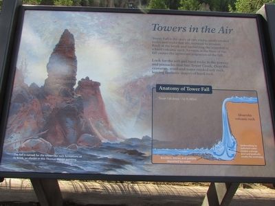
Towers in the Air
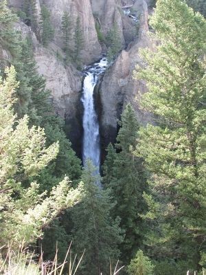
Tower Fall is the story of two rocks: easily eroded rocks and rocks that are resistant to erosion. Rock at the brink and underlying the waterfall is a hard volcanic rock. Erosion at the base of the fall causes the upstream migration of the fall.
Look for the soft and hard rocks in the towers and pinnacles that line Tower Creek. Over the centuries, wind and water eroded soft rock, leaving fantastic shapes of hard rock.
Erected by National Park Service.
Topics. This historical marker is listed in this topic list: Natural Features.
Location. 44° 53.596′ N, 110° 23.143′ W. Marker is in Yellowstone National Park, Wyoming, in Park County. It is in Mammoth. Marker can be reached from Grand Loop Road, on the right when traveling north. Marker is on a trail that begins by the Tower General Store. Touch for map. Marker is in this post office area: Yellowstone National Park WY 82190, United States of America. Touch for directions.
Other nearby markers. At least 8 other markers are within 10 miles of this marker, measured as the crow flies. Petrified Tree (approx. 3 miles away); Mt. Washburn Trail (approx. 5.6 miles away); Life in a Fire Tower (approx. 7 miles away); The Forest that Needs Fire (approx. 10 miles away); Forces of the Northern Range Self-Guiding Trail (approx. 10 miles away); Wolf Tracks (approx. 10 miles away); Fire – A Fundamental Force (approx. 10 miles away); Seasons of the Range (approx. 10 miles away). Touch for a list and map of all markers in Yellowstone National Park.
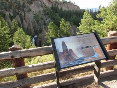
More about this marker. The background of the marker contains a picture with a caption of “The fall is named for the tower-like rock formations at its brink, as shown in this Thomas Moran painting.” An illustration of the Anatomy of Tower Fall appears at the lower right of the marker. It pictures Tower Fall dropping 132 ft (40m), flowing over Absaroka volcanic rock. At the bottom of the falls, undercutting by turbulent water creates a plunge pool and gradually erodes the overhang. Nearby, boulders, stones, and pebbles are deposited by water.
Credits. This page was last revised on February 16, 2023. It was originally submitted on September 7, 2015, by Bill Coughlin of Woodland Park, New Jersey. This page has been viewed 352 times since then and 12 times this year. Photos: 1, 2, 3, 4. submitted on September 7, 2015, by Bill Coughlin of Woodland Park, New Jersey.


