Fishers Hill in Shenandoah County, Virginia — The American South (Mid-Atlantic)
Fisher’s Hill
“Examples of energetic courage”
— 1864 Valley Campaign —
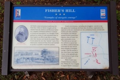
As Crook’s corps encountered small-arms fire from Gen. Cullen A. Battle’s brigade and the canister from the Amherst and Fluvanna batteries, a handful of Federals halted for a moment or turned and attempted to run. Enraged, Crook gathered an armful of rocks and pelted them on their heads in an effort to get them to reconsider their decision and resume the attack. While Crook coaxed the men who “tarried,” most of his infantrymen maintained their focus and marched as quickly as possible toward this position.
Crook’s two divisions-—excluding the stragglers—moved so rapidly against the Confederate left flank that all military organization disappeared as the men clambered over the undulating terrain covered with thickets and other obstacles. Nevertheless, the Federals pressed forward toward their objective. One of Crook’s brigade commanders wrote, “The field was so vast and the confusion so great that our officers could do little but encourage the men and set them examples of energetic courage. I feel the success is due, more than in any battle I know, to the splendid individual heroism of each of the men in the ranks.”
While Crook’s men charged, Ramseur ordered Gen. William R. Cox’s brigade to support Battle’s command.
(captions)
Gen. George Crook Courtesy Library of Congress
Union attack against the Confederate left flank - Courtesy Case Reserve Historical Society
Erected by Virginia Civil War Trails.
Topics and series. This historical marker is listed in this topic list: War, US Civil. In addition, it is included in the Virginia Civil War Trails series list. A significant historical date for this entry is September 22, 1864.
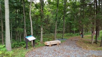
Location. 38° 59.268′ N, 78° 25.288′ W. Marker is in Fishers Hill, Virginia, in Shenandoah County. Marker can be reached from Battlefield Road (Virginia Route 601) 0.3 miles east of Tumbling Run Lane, on the left when traveling west. Located along the 1-mile loop trail on the Ramseur's Hill - Fisher's Hill Battlefield. Touch for map. Marker is at or near this postal address: 601 Battlefield Rd, Fishers Hill VA 22626, United States of America. Touch for directions.
Other nearby markers. At least 8 other markers are within walking distance of this marker. A different marker also named Fisher’s Hill (about 300 feet away, measured in a direct line); a different marker also named Fisher’s Hill (about 300 feet away); a different marker also named Fisher's Hill (about 300 feet away); a different marker also named Fisher’s Hill (about 300 feet away); a different marker also named Fisher’s Hill (about 800 feet away); a different marker also named Fisher’s Hill (approx. 0.2 miles away); a different marker also named Fisher’s Hill (approx. 0.2 miles away); Battle of Fisher’s Hill (approx. ¼ mile away). Touch for a list and map of all markers in Fishers Hill.
Also see . . .
1. Battle of Fisher’s Hill. Shenandoah at War website entry (Submitted on September 13, 2015.)
2. Fisher’s Hill. American Battlefield Trust website entry (Submitted on September 13, 2015.)
Credits. This page was last revised on June 2, 2022. It was originally submitted on September 13, 2015, by Bernard Fisher of Richmond, Virginia. This page has been viewed 500 times since then and 31 times this year. Photos: 1, 2. submitted on September 13, 2015, by Bernard Fisher of Richmond, Virginia. 3. submitted on April 6, 2021, by Bradley Owen of Morgantown, West Virginia.


