Near Catonsville in Baltimore County, Maryland — The American Northeast (Mid-Atlantic)
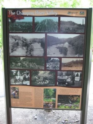
The Changing River Valley
During the industrial revolution, resource-hungry industries stripped trees from the hillsides to make charcoal. Every household needed wood as its lifeline for warmth and cooking - for survival.
Hillsides were left treeless, allowing mud to slither into the river, silting shipping channels, and clogging the port of Elkridge Landing. Factories dumped chemicals into the river, changing its color from orange to green then purple. These practices took their toll on people's lives and destroyed the valley's fish and wildlife habitat. The rich bank of natural resources was not endless.
A stripped landscape fostered larger floods. The wrath of the river's floodwaters removed much of the industrial burden. As new technology decreased industry's dependence on waterpower, surviving industries relocated to higher ground.
Human need for clean water and forest resources swung the pendulum toward conservation. In 1907, John glenn donated the first land for Patapsco Forest Reserve. Gradually land was added, trees were planted, visitors cam, and a park was born. The Reserve became our Patapsco Valley State Park. Though the valley today will never hold the divers native species that existed when Susquehannocks and Piscatoways lived beneath the big trees, Patapsco Valley State Park continues to manage its resources to benefit people, wildlife and the environment.
"We have learned a lot since the days when loggers cut everything down to six inches and entire mountains were coaled-off by the charcoal burners. This is the era of tree farms and state protected woodlands... we have come a long way." - Karl Pfeiffer, Assistant Director of Forests and Parks, 1912-1959
Text with photos, starting with upper left:
Kiln for making wood into charcoal.
Two C.C.C. men in front of what is now the Avalon Visitor Center.
Clear cut forest in Western Maryland.
Photo of Hockley Mill Dam taken from the Thomas Viaduct, 1870.
Photo of Hockley Dam and former Mill site in the 1970's, after restoration.
Swimming at Patapsco in the 1920's.
Ellicott Mill ruins after 1868 flood.
Photo of Avalon Dam control house with damage from 1972 flood.
Forest warden, Edmund G. Price.
Picnicking Hutzler campers in the 1920's.
Forest ranger unloading trees for planting, 1960's.
Erected by Maryland Department of Natural Resources, Chesapeake Bay Gateways Network.
Topics. This historical marker is listed in these topic lists: Colonial Era • Disasters
• Environment • Horticulture & Forestry • Industry & Commerce • Parks & Recreational Areas • Waterways & Vessels. A significant historical year for this entry is 1907.
Location. 39° 14.923′ N, 76° 45.89′ W. Marker is near Catonsville, Maryland, in Baltimore County. Marker can be reached from the intersection of Washington Boulevard (U.S. 1) and South Street. Marker is within the Patapsco Valley State Park - Orange Grove area, on the northern side of the Patapsco River (Grist Mill Trail), about 1.25 miles west of the Swinging Bridge. Vehicle entrance to PVSP is about 300 feet north of the US 1 - South Street intersection near Elkridge. A pedestrian entrance to the park is just across the river from this marker on Ilchester Road. Touch for map. Marker is in this post office area: Catonsville MD 21228, United States of America. Touch for directions.
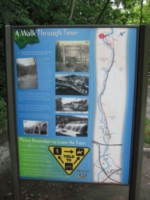
Other nearby markers. At least 8 other markers are within 2 miles of this marker, measured as the crow flies. Bringing Trade to Baltimore (here, next to this marker); The River Makes Electricity (approx. ¼ mile away); Building America's First Railroad (approx. ¾ mile away); Besley Demonstration Campsite (approx. one mile away); Orange Grove: A Small Neighborly Community (approx. one mile away); Back to Nature in the Patapsco Valley (approx. one mile away); Patapsco Superlative: (approx. one mile away); 20th Anniversary (approx. 1½ miles away). Touch for a list and map of all markers in Catonsville.
Credits. This page was last revised on August 6, 2021. It was originally submitted on July 6, 2008, by F. Robby of Baltimore, Maryland. This page has been viewed 1,798 times since then and 8 times this year. Photos: 1, 2. submitted on July 6, 2008, by F. Robby of Baltimore, Maryland.

