Canton in St. Lawrence County, New York — The American Northeast (Mid-Atlantic)
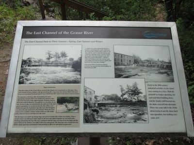
The East Channel of the Grasse River
The East Channel Dam in Three Seasons - Spring, Late Summer, and Winter
Inscription.
"...There was a dam behind Dishaw's foundry. A prolonged dry spell would lower the Grasse River until it didn't spill over the dam, but the water would still run through a raceway and help create a pool in a basin among the rocks some distance below the dam. We swam in that bason - without a stitch on! Getting across the raceway took some doing. You teetered across a plank that had been converted into a bridge."
The three dams on the Grasse River around Falls Island were constructed as crib dams. They were erected of heavy timbers, laid up something like a log house, the interior filled with stone. It was an economical if not permanent way to hold back the waters to be used as a power source.
To construct a crib dam, after determining the most appropriate location holes were drilled into bedrock. One end of an iron rod or bolt, approximately 30 inches long an inch and a half diameter, was split five or six inches at one end. An iron wedge was inserted into the split end of the bolt and it expanded as it was driven into the hole. Holes were drilled through the foundation logs that were then dropped over the bolts and anchored to the bedrock. When the river water is low a number of these anchor bolts are still visible today, bent over by ice and logs over the years.
The first layer was made up of large logs, run across to both sides of the river banks. Then a second course was laid up at right angles to the first and spiked together by iron drift bolts. Stacking and pinning the logs this way continued until the dam was four to six feet high and the spaces between the timbers were filled with stone and gravel. The dam face was vertical but was built to slope upstream and finished with planking to allow ice and debris to pass over. SLCHA (St. Lawrence County Historical Association), Canton Town and Village Historian's Office SLCHA
Early on the 20th century industrial activities on the island were coming to a close. With the gristmill no longer operating, the sash and blind building torn down, and the lumber mill burned out, the dams soon fell into disrepair. There was some talk in the 1930s about trying to put the dams back into operation, but nothing ever came of it.
Erected by Grasse River Heritage.
Topics. This historical marker is listed in these topic lists: Industry & Commerce • Waterways & Vessels. A significant historical year for this entry is 2003.
Location. 44° 35.79′ N, 75° 10.475′ W. Marker is in Canton, New York, in St. Lawrence County. Marker can be reached from West
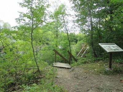
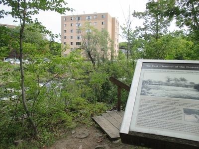
Main Street (U.S. 11) 0.2 miles east of Gouverneur Street (U.S. 11). Marker is on Heritage Trail on Falls Island in Heritage Park. The park is on the north side of US 11 between the two bridges over the Grasse River. Touch for map. Marker is in this post office area: Canton NY 13617, United States of America. Touch for directions.
Other nearby markers. At least 8 other markers are within walking distance of this marker. Logging and Lumbering (within shouting distance of this marker); Water Street and the Third Dam (within shouting distance of this marker); The Grist Mill (within shouting distance of this marker); The Sash and Blind Factory (within shouting distance of this marker); The West Channel of the Grasse River (within shouting distance of this marker); Floods, Fires, and Pollution (within shouting distance of this marker); The Natural Environment (about 300 feet away, measured in a direct line); The King Iron Bowstring Bridge (about 300 feet away). Touch for a list and map of all markers in Canton.
Credits. This page was last revised on December 17, 2017. It was originally submitted on September 19, 2015, by Anton Schwarzmueller of Wilson, New York. This page has been viewed 324 times since then and 15 times this year. Photos: 1, 2, 3, 4. submitted on September 19, 2015, by Anton Schwarzmueller of Wilson, New York.


