Missionary Ridge in Chattanooga in Hamilton County, Tennessee — The American South (East South Central)
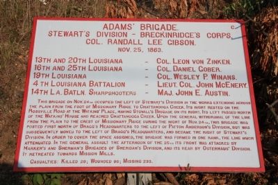
Adams' Brigade
Stewart's Division - Breckinridge's Corps.
— Col. Randall Lee Gibson. —
Stewart's Division - Breckinridge's Corps.
Col. Randall Lee Gibson.
Nov. 25, 1863.
13th and 20th Louisiana - Col. Leon von Zinken.
16th and 25th Louisiana - Col. Daniel Gober.
19th Louisiana - Col. Wesley P. Winans.
4th Louisiana Battalion - Lieut. Col. John McEnery.
14th La. Batln. Sharpshooters - Maj. John E. Austin.
This brigade on Nov. 24th occupied the left of Stewart's Division in the works extending across the plain from the foot of Missionary Ridge to Chattanooga Creek. Its right rested on the Rossville Road at the Watkins' House and reached Chattanooga Creek. Upon the general withdrawal of the line from the plain to the crest of Missionary Ridge during the night of Nov. 24th, this brigade was posted first north of Bragg's Headquarters to the left of Patton Anderson's Division, but was subsequently moved to the left of Bragg's Headquarters, and became the right of Stewart's Division. In order to cover the space assigned, the brigade was formed in one rank, the line much attenuated. In the general assault the afternoon of the 25th its front was attacked by Harker's and Sherman's Brigades of Sheridan's Division, and its rear by Osterhaus' Division. It retreated towards Mission Mills.
Casualties: Killed 28; Wounded 96; Missing 233.
Erected 1890 by the Chickamauga-Chattanooga National Battlefield Commission. (Marker Number MT-365.)
Topics and series. This historical marker is listed in this topic list: War, US Civil. In addition, it is included in the Chickamauga and Chattanooga National Military Park, Missionary Ridge, and the Chickamauga and Chattanooga National Military Park: November 25, 1863 series lists. A significant historical date for this entry is November 25, 1863.
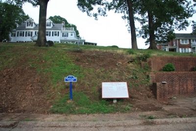
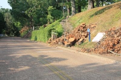
Location. 35° 1.055′ N, 85° 15.927′ W. Marker is in Chattanooga, Tennessee, in Hamilton County. It is in Missionary Ridge. Marker is on South Crest Road south of South Crest Place, on the left when traveling south. This historical marker is a short distance south of the Bragg Reservation, on the eastern side of the roadway, in front of the residence at 208 South Crest Road. Touch for map. Marker is in this post office area: Chattanooga TN 37404, United States of America. Touch for directions.
Other nearby markers. At least 8 other markers are within walking distance of this marker. Johnson's Division, Left of Assault (here, next to this marker); 19th Illinois Infantry (a few steps from this marker); 19th Illinois Infantry Regiment (a few steps from this marker); 69th Ohio Infantry (within shouting distance of this marker); 74th Illinois Infantry (about 300 feet away, measured in a direct line);
Sherman's Brigade (about 400 feet away); 88th Illinois Infantry (about 500 feet away); 24th Wisconsin Infantry (about 600 feet away). Touch for a list and map of all markers in Chattanooga.
Credits. This page was last revised on February 7, 2023. It was originally submitted on August 4, 2011, by Dale K. Benington of Toledo, Ohio. This page has been viewed 789 times since then and 23 times this year. Last updated on September 24, 2015, by Byron Hooks of Sandy Springs, Georgia. Photos: 1, 2, 3. submitted on August 4, 2011, by Dale K. Benington of Toledo, Ohio. • Bernard Fisher was the editor who published this page.


