Port Allen in West Baton Rouge Parish, Louisiana — The American South (West South Central)
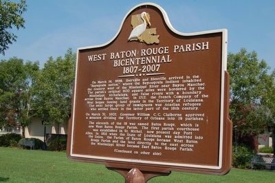
West Baton Rouge Parish Bicentennial
1807-2007
Side A
On March 14, 1699, Iberville and Bienville arrived in the “Bayagoula nation,” where the Bayougoula Indians inhabited the country west of the Mississippi River near Bayou Manchac. The parish’s original 600 square miles were bordered by the Mississippi, Atchafalaya, and False rivers with a boundary across from Bayou Manchac. In 1717, the French Company of the West began issuing land grants in the Territory of Louisiana. The next large group of immigrants were Acadian refugees who settled there in the latter part of the 18th century.
On March 31, 1807, Governor William C. C. Claiborne approved a measure dividing the Territory of Orleans into 19 parishes.
The eleventh of the 19 was named Baton Rouge, which is now West Baton Rouge Parish. The first parish courthouse was established in St. Michel, now present day Port Allen. In 1812 when the State of Louisiana was admitted into the Union, the Parish of Baton Rouge became West Baton Rouge Parish and the land directly to the east across the Mississippi River became East Baton Rouge Parish.
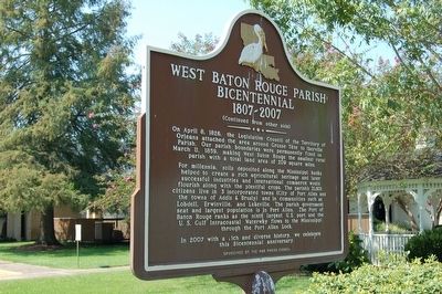
For millennia, soils deposited along the Mississippi banks helped to create a rich agricultural heritage and later successful industries and international commerce would flourish along with the plentiful crops. The parish’s 21,601 citizens live in 3 incorporated towns (City of Port Allen and the towns of Addis & Brusly) and in communities such as Lobdell, Erwinville, and Lukeville. The parish government seat and largest population is in Port Allen. The Port of Baton Rouge ranks as the ninth largest U.S. port and the U.S. Gulf Intracoastal Waterway flows to the Mississippi through the Port Allen Lock.
In 2007 with a rich and diverse history, we celebrate this Bicentennial anniversary.
Erected 2007 by WBR Parish Council.
Topics. This historical marker is listed in this topic list: Settlements & Settlers. A significant historical date for this entry is March 14, 1699.
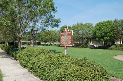
Location. 30° 27.592′ N, 91° 12.592′ W. Marker is in Port Allen, Louisiana, in West Baton Rouge Parish. Marker is on 8th Street south of Louisiana Avenue, on the right when traveling south. Touch for map. Marker is at or near this postal address: 850 8th Street, Port Allen LA 70767, United States of America. Touch for directions.
Other nearby markers. At least 8 other markers are within walking distance of this marker. Port Allen Prisoner-Of-War Sub-Camp No. 7 (approx. 0.2 miles away); Third Parish Courthouse (approx. ¼ mile away); Gear from Cinclare Mill (approx. ¼ mile away); Stone Square Lodge No. 8 (approx. ¼ mile away); Port Allen High School (1936-1978) / Port Allen Middle School (1979-Present) (approx. 0.3 miles away); Mississippi River (approx. 0.7 miles away); Mississippi River Old Ferry Landing (approx. 0.7 miles away); Louisiana Purchase - West Baton Rouge Early History (approx. 0.7 miles away). Touch for a list and map of all markers in Port Allen.
Credits. This page was last revised on February 25, 2024. It was originally submitted on September 26, 2015. This page has been viewed 327 times since then and 8 times this year. Photos: 1, 2, 3. submitted on September 26, 2015. • Bernard Fisher was the editor who published this page.


