Near South Lake Tahoe in El Dorado County, California — The American West (Pacific Coastal)
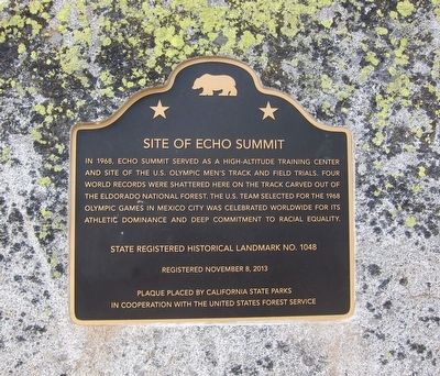
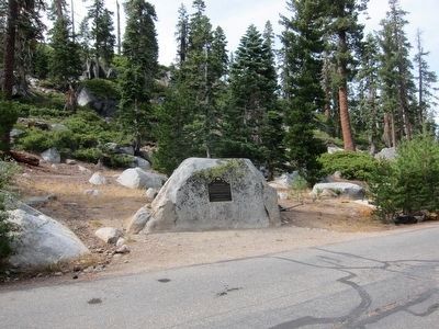
Site of Echo Summit
Erected 2013 by California State Parks and the United States Forest Service. (Marker Number 1048.)
Topics and series. This historical marker is listed in these topic lists: Civil Rights • Sports. In addition, it is included in the California Historical Landmarks series list. A significant historical year for this entry is 1968.
Location. 38° 48.859′ N, 120° 2.053′ W. Marker is near South Lake Tahoe, California, in El Dorado County. Marker can be reached from U.S. 50. Touch for map. Marker is at or near this postal address: 21200 Highway 50, South Lake Tahoe CA 96155, United States of America. Touch for directions.
Other nearby markers. At least 8 other markers are within 5 miles of this marker, measured as the crow flies. Luther Pass Trail - Prepared for the Ascent (approx. one mile away); Johnson Cutoff - Ascent of Johnson Pass (approx. one mile away); Luther Pass Trail - Enter Lake Valley (approx. 1.4 miles away); Yank’s Station (approx. 3.1 miles away); John (Snowshoe) Thompson (approx. 3.1 miles away); Yank’s Added Station (approx. 3.1 miles away); Luther Pass Trail - Came to Grass Lake (approx. 3.8 miles away); Luther Pass Trail - Luther Pass (approx. 5.1 miles away). Touch for a list and map of all markers in South Lake Tahoe.

Photographed By Andrew Ruppenstein, September 27, 2015
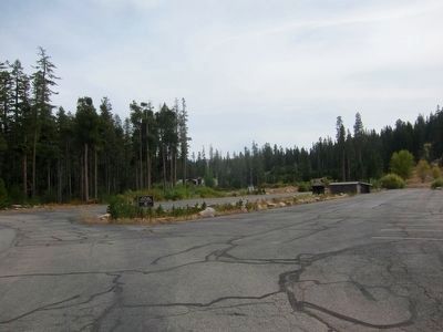
3. Echo Summit Olympic Practice Site - Now a Parking Lot
The practice site is now a parking lot, and little remains of the track other than the vaguely oval-shaped parking lot. The track itself was disassembled and reinstalled at the South Lake Tahoe Intermediate School, although it has since been replaced.
Credits. This page was last revised on September 29, 2020. It was originally submitted on September 28, 2015, by Andrew Ruppenstein of Lamorinda, California. This page has been viewed 637 times since then and 39 times this year. Photos: 1, 2, 3. submitted on September 30, 2015, by Andrew Ruppenstein of Lamorinda, California.

