Andersonville in Macon County, Georgia — The American South (South Atlantic)
The Expanded Stockade
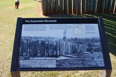
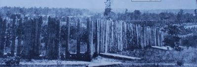
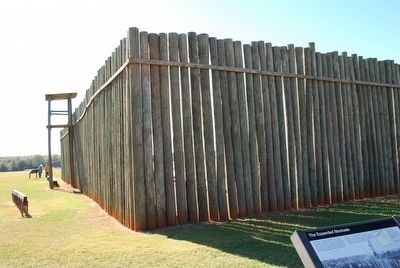
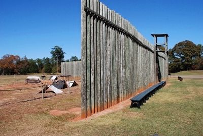
The unhewn logs with daylight between them betray the Confederates' haste to expand the north end of camp. In contrast, the reconstruction at the North Gate section show the carefully planned design of the stockade's initial 16 acres, when officials planned for only 6,000 prisoners.
The outer row of white posts marks the perimeter of the stockade; inner posts mark the deadline. The area between was a no man's land. If prisoners crossed the deadline, guards in the sentry boxes had orders to shoot them.
"July 1 was moving day for thousands of prisoners who had been cramped for sufficient room, and there was a perfect stampede for the new position."
James M. Page, 6th Michigan Cavalry, July 1, 1864
(captions)
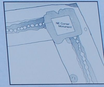
This stockade is an accurate reconstruction. Archeologists excavated stumps here that showed the size and spacing of stockade logs. They were able to map the location of each stockade post from the change in soil color produced by rotting wood.
The photograph shows the inner and middle stockade in 1867.
Erected by National Park Service.
Topics. This historical marker is listed in this topic list: War, US Civil. A significant historical date for this entry is July 1, 1864.
Location. 32° 11.767′ N, 84° 7.614′ W. Marker is in Andersonville, Georgia, in Macon County. Marker is on Prison Site Road, 0.2 miles Cemetery Road, on the right when traveling east. Touch for map. Marker is in this post office area: Andersonville GA 31711, United States of America. Touch for directions.
Other nearby markers. At least 8 other markers are within walking distance of this marker. Shebangs (within shouting distance of this marker); Pigeon-Roosts (within shouting distance of this marker); This Was Andersonville (about 400 feet away, measured in a direct line); Memorial to POWs at Hiroshima, Japan (about 400 feet away); The Battling Bastards of Bataan (about 400 feet away); Earthwork Defenses (about 400 feet away); To the Vermonters who Perished at Andersonville (about 400 feet away); Oflag 64 Prisoners of War (about 400 feet away). Touch for a list and map of all markers in Andersonville.
Also see . . . Andersonville National Historic Site. National Park Service (Submitted on October 2, 2015.)
Credits. This page was last revised on December 25, 2017. It was originally submitted on October 2, 2015, by Brandon Fletcher of Chattanooga, Tennessee. This page has been viewed 317 times since then and 9 times this year. Photos: 1, 2, 3, 4, 5. submitted on October 2, 2015, by Brandon Fletcher of Chattanooga, Tennessee. • Bernard Fisher was the editor who published this page.
