Carbondale in Lackawanna County, Pennsylvania — The American Northeast (Mid-Atlantic)
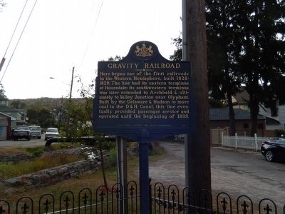
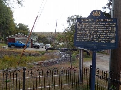
Gravity Railroad
Erected 1999 by Pennsylvania Historical & Museum Commission.
Topics and series. This historical marker is listed in this topic list: Railroads & Streetcars. In addition, it is included in the Pennsylvania Historical and Museum Commission series list. A significant historical year for this entry is 1899.
Location. 41° 34.517′ N, 75° 29.869′ W. Marker is in Carbondale, Pennsylvania, in Lackawanna County. Marker is at the intersection of Canaan Street (Business U.S. 6) and Belmont Street on Canaan Street. The marker is located at the rear entrance to Gravity Park. Touch for map. Marker is in this post office area: Carbondale PA 18407, United States of America. Touch for directions.
Other nearby markers. At least 8 other markers are within walking distance of this marker. Gravity Railroad Monument (a few steps from this marker); Gravity Park and the Gravity Railroad Historic Site (a few steps from this marker); Gravity Park (within shouting distance of this marker); Delaware & Hudson Canal Company Office Building (about 600 feet away, measured in a direct line); Church Street: Five of Carbondale’s many historic Churches (approx. 0.3 miles away); General Jerome F. O’Malley (approx. 0.3 miles away); Col. Alvin D. Ungerleider (approx. 0.3 miles away); War Memorial (approx. 0.3 miles away). Touch for a list and map of all markers in Carbondale.
Credits. This page was last revised on June 16, 2016. It was originally submitted on October 2, 2015, by Don Morfe of Baltimore, Maryland. This page has been viewed 402 times since then and 19 times this year. Photos: 1, 2. submitted on October 2, 2015, by Don Morfe of Baltimore, Maryland. • Bill Pfingsten was the editor who published this page.

