Liverpool in Brazoria County, Texas — The American South (West South Central)
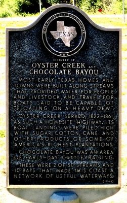
Vicinity of Oyster Creek and Chocolate Bayou
Oyster Creek served, 1822-1861, as such a homesite-highway. Its boat landings were piled high with sugar, cotton, cane and other products of some of America's richest plantations.
Chocolate Bayou was an area of early-day cattle raising.
These were 2 of 50 streams and 10 bays that made this coast a network of useful waterways.
Erected 1968 by State Historical Survey Committee. (Marker Number 9545.)
Topics. This historical marker is listed in these topic lists: Settlements & Settlers • Waterways & Vessels.
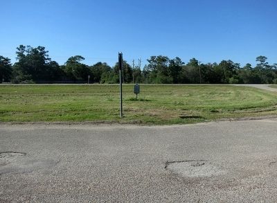
Location. Marker has been reported missing. It was located near 29° 19.997′ N, 95° 17.139′ W. Marker was in Liverpool, Texas, in Brazoria County. Marker was at the intersection of State Highway 35 and Oak Manor Drive (County Route 794), on the right when traveling north on State Highway 35. Touch for map. Marker was in this post office area: Liverpool TX 77577, United States of America. Touch for directions.
Other nearby markers. At least 8 other markers are within 7 miles of this location, measured as the crow flies. Liverpool Post Office (approx. 2.8 miles away); Liverpool Cemetery (approx. 2.9 miles away); Thomas Jefferson Callihan (approx. 2.9 miles away); First Methodist Church of Alvin (approx. 5.7 miles away); Old City Cemetery (approx. 6.1 miles away); Birchfield - McCown House (approx. 6.4 miles away); First Presbyterian Church of Alvin (approx. 6.4 miles away); Cummings - Smith House (approx. 6˝ miles away). Touch for a list and map of all markers in Liverpool.
More about this marker. This marker is in a wide horseshoe pulloff on the south side of Texas 35. It is not a roadside park as some descriptions say. There's nothing at this pulloff except this marker, except maybe a place to rest if you have driven a long time or you need to use your phone.
Credits. This page was last revised on March 5, 2024. It was originally submitted on October 4, 2015, by Jim Evans of Houston, Texas. This page has been viewed 1,141 times since then and 82 times this year. Photos: 1, 2. submitted on October 4, 2015, by Jim Evans of Houston, Texas. • Bernard Fisher was the editor who published this page.

