Chadron in Dawes County, Nebraska — The American Midwest (Upper Plains)
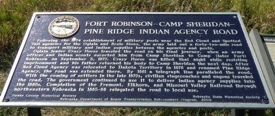
Fort Robinson - Camp Sheridan - Pine Ridge Indian Agency Road
Inscription.
Following the 1874 establishment of military posts near the Red Cloud and Spotted Tail agencies for the Oglala and Brule Sioux, the army laid out a forty-two-mile road to transport military and Indian supplies between the agencies and posts.
Oglala leader Crazy Horse traveled the road on his final journey, when an army officer and Indian scouts escorted him from Camp Sheridan to Camp (later Fort) Robinson on September 5, 1877. Crazy Horse was killed that night while resisting imprisonment and his father returned his body to Camp Sheridan the next day. After Red Cloud Agency was relocated to Dakota Territory in 1878 and renamed Pine Ridge Agency, the road was extended there. By 1881 a telegraph line paralleled the road.
With the coming of settlers in the late 1870s, civilian stagecoaches and wagons traveled the road. The government continued to use it to deliver Indian agency supplies into the 1880s. Completion of the Fremont, Elkhorn, and Missouri Valley Railroad through northwestern Nebraska in 1885-86 relegated the road to local use.
Erected 2008 by Dawes County Historical Society, Nebraska State Historical Society and Nebraska Department of Roads Transportation Enhancement Program. (Marker Number 465.)
Topics. This historical marker is listed in these topic lists: Native Americans • Roads & Vehicles • Wars, US Indian. A significant historical date for this entry is September 5, 1877.
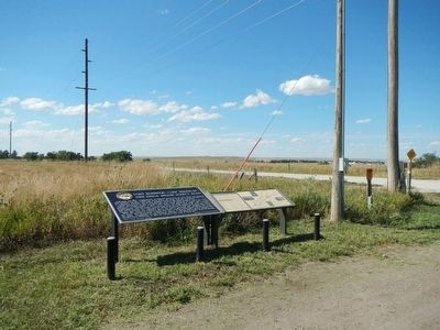
Location. 42° 48.828′ N, 103° 1.11′ W. Marker is in Chadron, Nebraska, in Dawes County. Marker is at the intersection of U.S. 385 and West 16th Street, on the left when traveling north on U.S. 385. This marker is located at the southwest corner of the intersection of Highway 385 and West 16th Street in Chadron, Nebraska. Touch for map. Marker is in this post office area: Chadron NE 69337, United States of America. Touch for directions.
Other nearby markers. At least 7 other markers are within 5 miles of this marker, measured as the crow flies. Historic Northwestern Nebraska (here, next to this marker); Chadron State College (approx. one mile away); The First Church in Chadron (approx. 1.3 miles away); The Chadron-Chicago Cowboy Race (approx. 1˝ miles away); The Fort Pierre-Fort Laramie Trail (approx. 2.9 miles away); Bordeaux Trading Post (approx. 4.1 miles away); Chadron Creek Trading Post (approx. 4.6 miles away).
Credits. This page was last revised on June 16, 2016. It was originally submitted on October 5, 2015, by Barry Swackhamer of Brentwood, California. This page has been viewed 507 times since then and 27 times this year. Photos: 1, 2. submitted on October 5, 2015, by Barry Swackhamer of Brentwood, California.

