Austin in Lander County, Nevada — The American Mountains (Southwest)
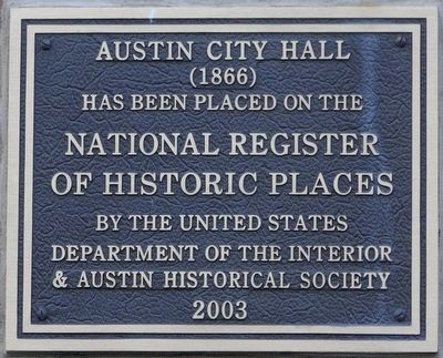
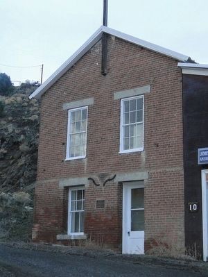
Austin City Hall
(1866)
(1866)
Has been placed on the
National Register
Of Historic Places
By the United States
Department of the Interior
& Austin Historical Society
2003
Erected 2003 by Austin Historical Society.
Topics. This historical marker is listed in these topic lists: Architecture • Government & Politics. A significant historical year for this entry is 1866.
Location. 39° 29.529′ N, 117° 4.315′ W. Marker is in Austin, Nevada, in Lander County. Marker is at the intersection of South Street and Virginia Hill on South Street. Touch for map. Marker is in this post office area: Austin NV 89310, United States of America. Touch for directions.
Other nearby markers. At least 8 other markers are within walking distance of this marker. Votes for Women (about 400 feet away, measured in a direct line); The Pony Express (about 400 feet away); Austin Masonic and Oddfellows Hall (1867) (about 400 feet away); Lander County Courthouse (about 400 feet away); The Sazerac Lying Club (about 400 feet away); Reese River Navigation Company (about 400 feet away); Austin City Railway (about 400 feet away); St. Augustine (about 500 feet away). Touch for a list and map of all markers in Austin.
Additional commentary.
1. A little history about Lander County
Lander County was formed on December 19, 1862 and was named after General Frederick W. Lander, Civil War hero and prominent builder of a wagon road across Nevada. Situated in the center of the state, the Lander County region attracted prospectors fanning out across the Great Basin after the 1859 discovery of the Comstock Lode. The County originally encompassed the eastern third of the State and was called "The Mother of Counties." It was later divided into the Counties of Lander, Eureka, White Pine, and Elko. The first County seat was located in Jacobsville, six miles west of Austin. In September, 1863, voters mandated its move to Austin and in May, 1979 to Battle Mountain.
Located in north central Nevada, Lander County encompasses 5,621 square miles. Over 85 percent of the County is currently public land managed by federal agencies. Interstate 80 traverses the County in an east-west fashion on the northern end, as does Highway 50 on the southern end. State Highway 305.
Source: Lander County website
— Submitted October 10, 2015.
Credits. This page was last revised on December 22, 2020. It was originally submitted on October 9, 2015, by Trev Meed of Round Mountain, Nevada. This page has been viewed 308 times since then and 28 times this year. Photos: 1, 2. submitted on October 9, 2015, by Trev Meed of Round Mountain, Nevada. • Syd Whittle was the editor who published this page.

