Westfield in Union County, New Jersey — The American Northeast (Mid-Atlantic)
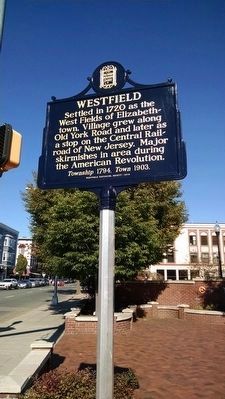
Westfield
Erected 2014 by Westfield Historical Society.
Topics. This historical marker is listed in these topic lists: Colonial Era • Settlements & Settlers • War, US Revolutionary. A significant historical year for this entry is 1720.
Location. 40° 39.002′ N, 74° 20.974′ W. Marker is in Westfield, New Jersey, in Union County. Marker is at the intersection of North Avenue (New Jersey Route 28) and E. Broad Street (County Route 509), on the right when traveling west on North Avenue. Marker is located on the northeasterly side of Memorial Plaza, on the corner of North Avenue (NJ Route 28) and E. Broad Street (Union County Route 509). It is adjacent to the PNC Bank property. Touch for map. Marker is at or near this postal address: Memorial Plaza, Westfield NJ 07090, United States of America. Touch for directions.
Other nearby markers. At least 8 other markers are within 2 miles of this marker, measured as the crow flies. Downer Well Cap (approx. ¼ mile away); Meeting House (approx. ¼ mile away); Presbyterian Church in Westfield (approx. ¼ mile away); Men of Westfield (approx. ¼ mile away); Revolutionary War Soldiers (approx. ¼ mile away); Revolutionary Cemetery (approx. 0.3 miles away); Westfield Church (approx. 0.3 miles away); Gallows Hill (approx. 1.2 miles away). Touch for a list and map of all markers in Westfield.
More about this marker. Marker was sponsored by the Westfield Historical Society, in honor of New Jersey's 350th year celebration.
Credits. This page was last revised on June 16, 2016. It was originally submitted on October 9, 2015, by Michael La Place of Westfield, New Jersey. This page has been viewed 385 times since then and 25 times this year. Photo 1. submitted on October 13, 2015, by Michael La Place of Westfield, New Jersey. • Bill Pfingsten was the editor who published this page.
