Near Livermore in Larimer County, Colorado — The American Mountains (Southwest)
Virginia Dale
Virginia Dale
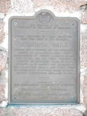
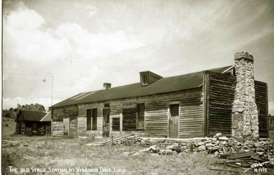
famous stage station on the overland route to California, 1862 - 1867. Established by Joseph A. (Jack) Slade and named for his wife, Virginia. Located on the Cherokee Trail of 1849. Favorite camp ground for emigrants. Vice President Colfax and party were detained here by Indian raids in 1865. Robert J. Spotswood replaced Slade.
Erected 1935 by The State Historical Society of Colorado and the Fort Collins Pioneer Society.
Topics and series. This historical marker is listed in this topic list: Roads & Vehicles. In addition, it is included in the Overland Trail series list.
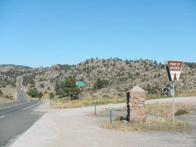
Location. 40° 57.443′ N, 105° 21.277′ W. Marker is near Livermore, Colorado, in Larimer County. Marker is at the intersection of U.S. 287 and County Route 43F, on the right when traveling north on U.S. 287. Touch for map. Marker is at or near this postal address: 31890 US Highway 287, Livermore CO 80536, United States of America. Touch for directions.
Other nearby markers. At least 8 other markers are within 13 miles of this marker, measured as the crow flies. A different marker also named Virginia Dale (approx. 2.6 miles away); The Overland Stage Line (approx. 4.1 miles away in Wyoming); Tree in the Rock (approx. 12.2 miles away in Wyoming); Lonetree on the Laramie Range (approx. 12.2 miles away in Wyoming); Tree Rock (approx. 12.2 miles away in Wyoming); Sherman Mountains (approx. 12.2 miles away in Wyoming); Pyramid on the Plains (approx. 12.2 miles away in Wyoming); The Transcontinental Railroad (approx. 12.2 miles away in Wyoming).
Also see . . . Virginia Dale, Colorado - Wikipedia. Virginia Dale was a "home station" on the Overland Trail, meaning that passengers could disembark, get a meal, and stay overnight in a hotel if the stage was delayed by weather or nightfall. Thirty to fifty horses were kept at the station which was located in a pleasant, grassy glade (or "dale") along a clear bubbling stream, later named Dale Creek. (Submitted on October 13, 2015, by Barry Swackhamer of Brentwood, California.)
Credits. This page was last revised on June 16, 2016. It was originally submitted on October 13, 2015, by Barry Swackhamer of Brentwood, California. This page has been viewed 676 times since then and 25 times this year. Photos: 1, 2, 3. submitted on October 13, 2015, by Barry Swackhamer of Brentwood, California.


