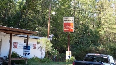
Blues Old Stand in Bullock County, Alabama — The American South (East South Central)
Three Notch Road
Side 1
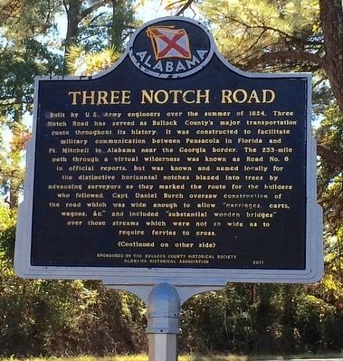
Built by U.S. Army engineers over the summer of 1824, Three Notch Road has served as Bullock County’s major transportation route throughout its history. It was constructed to facilitate military communication between Pensacola in Florida and Ft. Mitchell in Alabama near the Georgia border. The 233-mile path through a virtual wilderness was known as Road No. 6 in official reports, but was known and named locally for the distinctive horizontal notches blazed into trees by advancing surveyors as they marked the route for the builders who followed. Capt. Daniel Burch oversaw construction of the road which was wide enough to allow “carriages, carts, wagons, &c.” and included “substantial wooden bridges” over those streams which were not so wide as to require ferries to cross.
Side 2
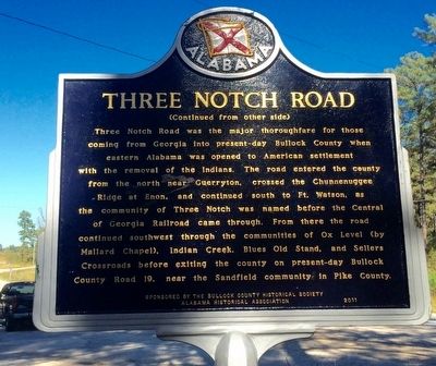
Three Notch Road was the major thoroughfare for those coming from Georgia into present-day Bullock County when eastern Alabama was opened to American settlement with the removal of the Indians. The road entered the county from the north near Guerryton, crossed the Chunnenuggee Ridge at Enon, and continued south to Ft. Watson, as the community of Three Notch was named before the Central of Georgia Railroad came through. From there the road continued southwest through the communities of Ox Level (by Mallard Chapel), Indian Creek, Blues Old Stand, and Sellers Crossroads before exiting the county on present-day Bullock County Road 19, near the Sandfield community in Pike County.
Erected 2011 by the Bullock County Historical Society, Alabama Historical Association.
Topics and series. This historical marker is listed in these topic lists: Military • Roads & Vehicles • Settlements & Settlers. In addition, it is included in the Alabama Historical Association series list. A significant historical year for this entry is 1824.
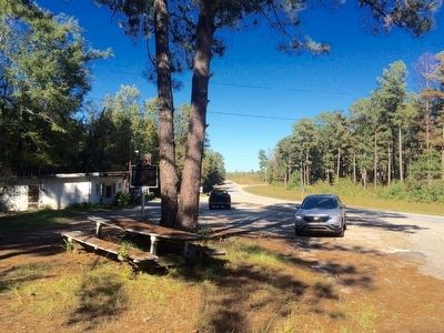
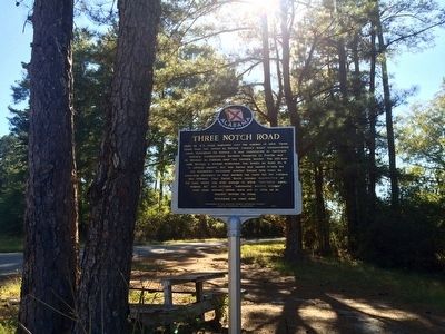
Location. 31° 59.14′ N, 85° 42.929′ W. Marker is in Blues Old Stand, Alabama, in Bullock County. Marker is at the intersection of U.S. 29 and County Road 19, on the right when traveling south on U.S. 29. Touch for map. Marker is in this post office area: Union Springs AL 36089, United States of America. Touch for directions.
Other nearby markers. At least 8 other markers are within 11 miles of this marker, measured as the crow flies. Samuel Sellers Cemetery (approx. 2 miles away); Perote Bullock County (approx. 2.7 miles away); Aberfoil Community (approx. 6 miles away); Aberfoil School (approx. 6.4 miles away); Sardis Baptist Church, Cemetery, and School (approx. 7.7 miles away); Mt. Pleasant Cemetery (approx. 9.6 miles away); Indian Treaty Boundary Line (approx. 9.9 miles away); Mt. Hilliard Methodist Church (approx. 10.4 miles away).
More about this marker. According to one account, Blues Old Stand was named for a man named Blue who kept a store known locally as the 'stand'.
Regarding Three Notch Road. The origin of "Three Notch" came from the practice of marking trees with three blazes or notches to show the way of a trail or route for creating a new road.
Related markers. Click here for a list of markers that are related to this marker.
Also see . . .
1. Andalusia Star News article on the Three Notch & Old Federal Road. (Submitted on October 14, 2015, by Mark Hilton of Montgomery, Alabama.)
2. Andalusia Star News article on the Three Notch Road. (Submitted on October 14, 2015, by Mark Hilton of Montgomery, Alabama.)
Credits. This page was last revised on July 25, 2018. It was originally submitted on October 14, 2015, by Mark Hilton of Montgomery, Alabama. This page has been viewed 1,724 times since then and 148 times this year. Photos: 1, 2, 3, 4, 5. submitted on October 14, 2015, by Mark Hilton of Montgomery, Alabama.
