Henrietta Township near Pleasant Lake in Jackson County, Michigan — The American Midwest (Great Lakes)
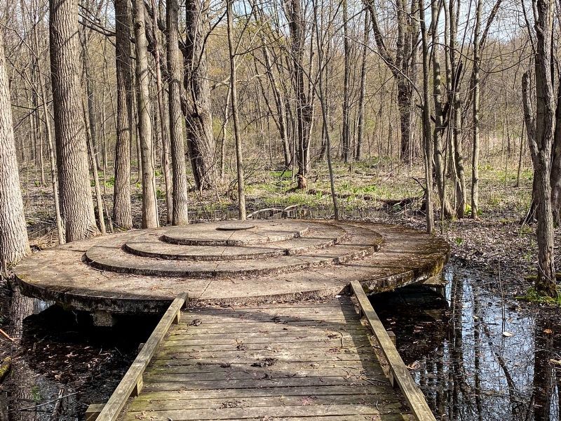
Meridian-Base Line Initial Point / Meridian-Base Line Dual Initial Points
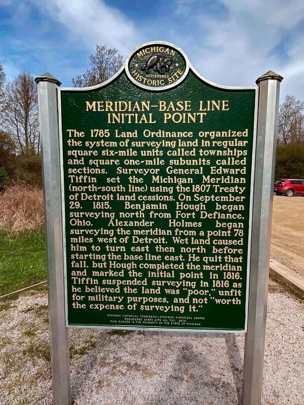
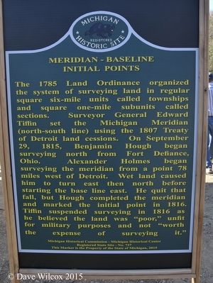
The 1785 Land Ordinance organized the system of surveying land in regular square six-mile units called townships and square one-mile subunits called sections. Surveyor General Edward Tiffin set the Michigan Meridian (north-south line) using the 1807 Treaty of Detroit land cessions. On September 29, 1815, Benjamin Hough began surveying north from Fort Defiance, Ohio. Alexander Holmes began surveying the meridian from a point 78 miles west of Detroit. Wet land caused him to turn east then north before starting the base line east. He quit that fall, but Hough completed the meridian and marked the initial point in 1816. Tiffin suspended surveying in 1816 as believed the land was "poor," unfit for military purposes, and not "worth the expense of surveying it."
Meridian-Base Line Dual Initial Points
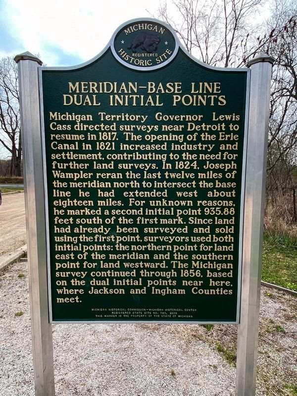
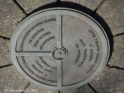
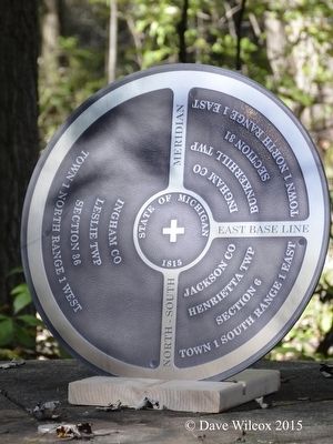
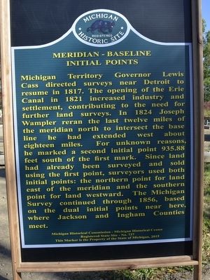
Michigan Territory Governor Lewis Cass directed surveys near Detroit to resume in 1817. The opening of the Erie Canal in 1821 increased industry and settlement, contributing to the need for further land surveys. In 1824, Joseph Wampler reran the last twelve miles of the meridian north to intersect the base line he had extended west about eighteen miles. For unknown reasons, he marked a second initial point 935.88 feet south of the first mark. Since land had already been surveyed and sold using the first point, surveyors used both initial points: the northern point for land east of the meridian and the southern point for land westward. The Michigan Survey continued through 1856, based on the dual initial points near here, where Jackson and Ingham Counties meet.
Erected 2015 by Michigan Historical Commission - Michigan Historical Center. (Marker Number S737.)
Topics and series. This historical marker is listed in these topic lists: Exploration • Industry & Commerce • Science & Medicine • Settlements & Settlers. In addition, it is included in the Michigan Historical Commission series list.
Location. 42° 25.385′ N, 84° 21.404′ W. Marker is near Pleasant Lake, Michigan, in Jackson County. It is in Henrietta Township. Marker can be reached from Meridian Road, 0.8 miles north of North Territorial Road, on the left when traveling north. The initial point markers are located in the Meridian-Baseline State Park. Touch for map. Marker is in this post office area: Pleasant Lake MI 49272, United States of America. Touch for directions.
Other nearby markers. At least 8 other markers are within 10 miles of this marker, measured as the crow flies. This Boulder (approx. 2˝ miles away); First Baptist Church (approx. 4.2 miles away); City of Leslie (approx. 4.3 miles away); Tuttle Park Veterans Memorial (approx. 4.4 miles away); Sts. Cornelius and Cyprian Church (approx. 5.3 miles away); Seasonal Labor (approx. 8.4 miles away); Stockbridge (approx. 9.2 miles away); Stockbridge Town Hall (approx. 9.2 miles away).
More about this marker. The historical marker is located at the west the Meridian-Baseline State Park parking area at the trailhead to the initial point markers. This a round trip of approximately 1.5 miles along compacted gavel trail.
Regarding Meridian-Base Line Initial Point / Meridian-Base Line Dual Initial Points. 2015 marks the 200th anniversary of the setting of the surveying lines for Michigan. In 1785 a public land survey proposed by Thomas Jefferson was an efficient method for the establishment of land boundaries and even today affects all land owners. Every parcel of land within the state of Michigan is surveyed from these initial points. In 1807, the west boundary of the Treaty of Detroit was selected as the line for the Michigan Principal Meridian; the southernmost (and beginning point) of the meridian was set in 1815 at Fort Defiance, Ohio and the northernmost
(and final) point was set in 1840 in Sault Ste. Marie.
Credits. This page was last revised on March 20, 2023. It was originally submitted on October 13, 2015, by Dave Wilcox of Grass Lake, Michigan. This page has been viewed 1,215 times since then and 129 times this year. Last updated on April 26, 2021, by Carl Gordon Moore Jr. of North East, Maryland. Photos: 1, 2. submitted on April 25, 2021, by J.T. Lambrou of New Boston, Michigan. 3. submitted on January 5, 2023, by Joel Seewald of Madison Heights, Michigan. 4, 5. submitted on October 13, 2015, by Dave Wilcox of Grass Lake, Michigan. 6. submitted on April 25, 2021, by J.T. Lambrou of New Boston, Michigan. 7, 8. submitted on October 13, 2015, by Dave Wilcox of Grass Lake, Michigan. • Mark Hilton was the editor who published this page.
