Oak Ridge in Anderson County, Tennessee — The American South (East South Central)
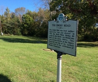
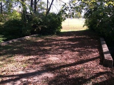
The Emery Road
Erected by Tennessee Historical Commission. (Marker Number 1D 34.)
Topics and series. This historical marker is listed in these topic lists: Bridges & Viaducts • Roads & Vehicles • Settlements & Settlers. In addition, it is included in the Tennessee Historical Commission series list.
Location. 36° 0.756′ N, 84° 15.877′ W. Marker is in Oak Ridge, Tennessee, in Anderson County. Marker is at the intersection of Oak Ridge Turnpike (County Route 95) and Robertsville Road, on the right on Oak Ridge Turnpike. This is one of two markers for Emory Road. The other is at Blaine TN on the Northeast end of Road where it meets Rutledge Pike 11W. Touch for map. Marker is in this post office area: Oak Ridge TN 37830, United States of America. Touch for directions.
Other nearby markers. At least 8 other markers are within walking distance of this marker. Midtown Community Center (within shouting distance of this marker); Grove Center (about 700 feet away, measured in a direct line); International Friendship Bell (approx. 0.2 miles away); The Swimming Hole (approx. ¼ mile away); Oak Ridge Municipal Outdoor Swimming Pool (approx. ¼ mile away); Dedicated to the Memory of Those from Oak Ridge Who Gave Their Lives That Freedom Might Live (approx. 0.4 miles away); The Birth of the City of Oak Ridge, Tennessee (approx. 0.4 miles away); a different marker also named The Birth of the City of Oak Ridge, Tennessee (approx. 0.4 miles away). Touch for a list and map of all markers in Oak Ridge.
Credits. This page was last revised on September 2, 2020. It was originally submitted on October 17, 2015, by Donald Raby of Knoxville, Tennessee. This page has been viewed 1,043 times since then and 68 times this year. Photos: 1, 2, 3, 4. submitted on October 17, 2015, by Donald Raby of Knoxville, Tennessee. • Bill Pfingsten was the editor who published this page.


