Castlewood in Russell County, Virginia — The American South (Mid-Atlantic)
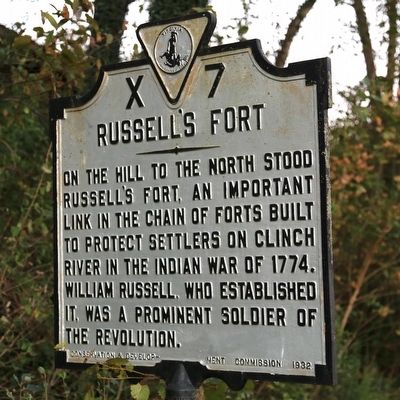
Russellís Fort
Erected 1932 by Conservation and Development Commission. (Marker Number X-7.)
Topics and series. This historical marker is listed in these topic lists: Forts and Castles • Native Americans • Settlements & Settlers • Wars, US Indian. In addition, it is included in the Virginia Department of Historic Resources (DHR), and the Virginia, Clinch River Forts Circa 1774 series lists. A significant historical year for this entry is 1774.
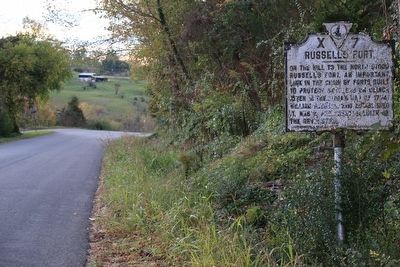
Location. 36° 52.638′ N, 82° 16.428′ W. Marker is in Castlewood, Virginia, in Russell County. Marker is on Memorial Drive (County Route 683) east of Quarry Road (County Route 694), on the left when traveling east. Touch for map. Marker is in this post office area: Castlewood VA 24224, United States of America. Touch for directions.
Other nearby markers. At least 8 other markers are within 10 miles of this marker, measured as the crow flies. Veterans Memorial (approx. 2.8 miles away); Old Russell County Courthouse (approx. 3.2 miles away); Mooreís Fort (approx. 3.4 miles away); Dortonís Fort (approx. 4.7 miles away); Jesseeís Mill (approx. 6.6 miles away); Early Settlers in Russell County (approx. 7Ĺ miles away); Glade Hollow Fort (approx. 8.7 miles away); Russell County / Washington County (approx. 9.8 miles away).
More about this marker. Back in 1932, Virginia historical markers were only erected on primary roads. This marker has not been moved. When this marker was erected, this roadway was a Virginia primary road, Route 64, that ran from Norton to Lebanon via Coeburn and St. Paul.
Also see . . . Frontier Forts in Southwestern Virginia. 1968 sketch by Emory L. Hamilton. “It has been stated by some writers that not a single palisaded fort existed along the Clinch frontier until after the circulation of Lord Dunmore's order requesting that such be built. Those making these statements used the argument that after the end of the French and Indian War that peace existed and there was no need of palisaded forts. It is probably quite true that prior to 1774 there were no real palisaded forts, the inhabitants depending on strongly built fort houses with port holes for warding off surprise Indian attacks. Some of these still stand today, such as the old Osborne house in lower Castlewood and the Dickenson house on Clinch River north of Castlewood. However, those who aver that prior to 1774 peace existed between the Indians and whites need to review their frontier history.” (Submitted on October 21, 2015.)
Credits. This page was last revised on June 16, 2016. It was originally submitted on October 21, 2015, by J. J. Prats of Powell, Ohio. This page has been viewed 2,327 times since then and 168 times this year. Photos: 1, 2. submitted on October 21, 2015, by J. J. Prats of Powell, Ohio.

