Near Frederick in Frederick County, Maryland — The American Northeast (Mid-Atlantic)
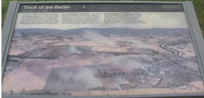
Thick of the Battle
4:00 - 4:30 p.m. July 9, 1864
— Monocacy National Battlefield, National Park Service, U.S. Department of the Interior —
The Battle of Monocacy changed from a stalemate to a rout as the final lines of Maj. Gen. John B. Gordon's three Confederate brigades swept down Brooks Hill onto the fields of Thomas farm. Both sides traded blistering gunfire around the Thomas house and outbuildings and along the ridge toward the Monocacy River. Numerous soldiers and officers lay dead or wounded on the fields and in the streams. Running low on ammunition, Union troops fell back to the Georgetown Pike (today's Route 355) and toward the Gambrill Mill area as Maj. Gen. Lew Wallace gave the order to retreat. Meanwhile, across the river, Confederate Lt. Gen. Jubal A. Early's troops under Maj. Gen. Stephen D. Ramseur drove back a small Federal force across the railroad bridge.
Erected by National Park Service, U.S. Department of the Interior.
Topics. This historical marker is listed in this topic list: War, US Civil. A significant historical date for this entry is July 9, 1864.
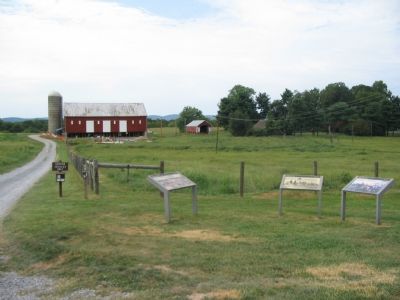
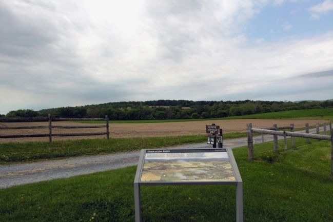
Location. Marker has been reported missing. It was located near 39° 21.434′ N, 77° 23.471′ W. Marker was near Frederick, Maryland, in Frederick County. Marker was on Baker Valley Road, on the right when traveling south. Located at stop four of the auto-tour of Monocacy Battlefield. This marker set is at the trail head for the Thomas Farm walking tour. Touch for map. Marker was in this post office area: Frederick MD 21704, United States of America. Touch for directions.
Other nearby markers. At least 8 other markers are within walking distance of this location. Final Attack (within shouting distance of this marker); Civilians Under Siege (within shouting distance of this marker); 10th Vermont Monument (approx. 0.3 miles away); State of Pennsylvania Monument (approx. 0.3 miles away); Final Stand (approx. 0.3 miles away); Clustered Spires of Frederick (approx. half a mile away); History of the Monocacy River Valley (approx. half a mile away); The Battle That Saved Washington (approx. half a mile away). Touch for a list and map of all markers in Frederick.
More about this marker. The background of the marker is a "bird's eye" view of the battle area with labels indicating important locations on the battlefield.
Related markers. Click here for a list of markers that are related to this marker. This marker is among several describing the battle of Monocacy, to "tour" the battlefield using the related HMBd markers sites.
Also see . . . Battle of Monocacy. National Park Service site. (Submitted on November 4, 2007, by Craig Swain of Leesburg, Virginia.)
Photographed By Craig Swain, May 26, 2007
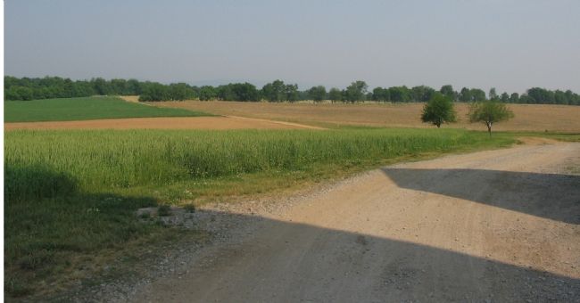
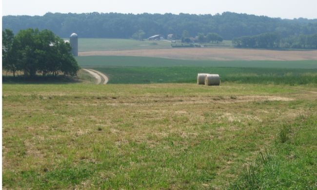
3. Fields of Thomas Farms
Looking to the west from the Thomas Farm, Confederates and Federals fought across these fields in the afternoon of July 9, 1864 and decided the battle of Monocacy. Although the Federal units were mixed up during the action, Rickett's Division defending here had a brigade under Colonel William S. Truex on the left (closest to the camera) and another under Colonel Matthew R. McClennan on the right (centered on the tree line in the middle of the fields).
Note the shadows of the silo on the ground, and compare to the next photo's view of the silo. The distance to the far tree line, where US Interstate 270 crosses the Monocacy, is just over half a mile.
Note the shadows of the silo on the ground, and compare to the next photo's view of the silo. The distance to the far tree line, where US Interstate 270 crosses the Monocacy, is just over half a mile.
Photographed By Craig Swain, May 26, 2007
4. The Thomas Farm seen from the West
From a point near modern U.S. Interstate 270, this view looks back to the Thomas Farm. The Confederate battle line in the final phases of the battle advanced from the right side of view, against the Federals on the left. The Confederate cavalry under Brig. Gen. John McCausland made two unsuccessful attacks on the Federal lines before Maj. Gen. John B. Gordon's Confederate Division arrived in position. Gordon's division arrayed from east (closest to the camera) to west - Brig. Gen. William Terry's (Stonewall) Brigade, Brig. Gen. Zubelon York's (Louisiana) Brigade, and Brig. Gen. Clement Evans (Georgia) Brigade.
Placing the point of view in perspective, photo number 3 in this set was taken near the silo of the barn in the distance.
Placing the point of view in perspective, photo number 3 in this set was taken near the silo of the barn in the distance.
Photographed By Craig Swain, September 9, 2007
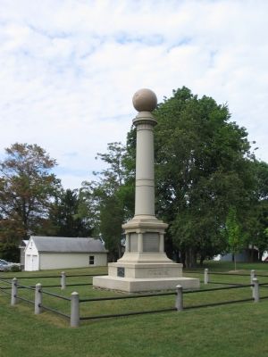
5. The Pennsylvania Monument
Costing $8,000 in 1908, this monument is dedicated to the 67th, 87th, and 138th Pennsylvania Regiments. The monument is located at the intersection of Araby Church and Baker Valley Roads. The 138th Regiment held a position on the center of the Federal lines for a major part of the day. The 87th was engaged on the right side of the line closer to the Thomas Farm. Later, both regiments were part of the final Federal defensive line formed along this road in the late afternoon. While memorialized here, the 67th Regiment actually was held up at New Market, MD, about five miles to the west throughout the day.
Credits. This page was last revised on April 27, 2022. It was originally submitted on November 4, 2007, by Craig Swain of Leesburg, Virginia. This page has been viewed 1,903 times since then and 10 times this year. Last updated on October 26, 2015, by Shane Oliver of Richmond, Virginia. Photos: 1, 2, 3, 4, 5. submitted on November 4, 2007, by Craig Swain of Leesburg, Virginia. 6. submitted on February 22, 2014, by Duane Hall of Abilene, Texas. • Bill Pfingsten was the editor who published this page.
