Hardeeville in Jasper County, South Carolina — The American South (South Atlantic)
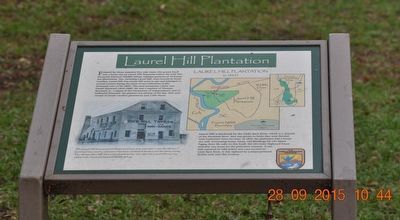
Laurel Hill Plantation
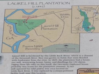
Laurel Hill is bordered by the Little Back River, which is a channel of the Savannah River. Rice was grown in fields that were flooded with fresh water from the river. In, 1825, the plantation had a house, rice mill, winnowing house, barns, and dwellings for 150 slaves. Facing three life oaks on this knoll, the two-story clapboard house probably was home for the plantation overseers. A rice mill operated by tidal power was once located on Little Back River. It was replaced by a steam-powered facility built near this location.
(caption)
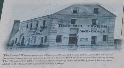
The Laurel Hill steam-powered mill operated from 1833 until 1880. Later the mill was converted into a tavern, rumored to have been a hotbed of drunken and disorderly activity. The infamous Rice Mill Tavern was abandoned by 1934, when the Laurel Hill tract was added to the Savannah National Wildlife Refuge.
Erected by U.S. Fish & Wildlife Service, Department of the Interior.
Topics. This historical marker is listed in this topic list: Notable Places. A significant historical year for this entry is 1842.
Location. 32° 9.942′ N, 81° 6.916′ W. Marker is in Hardeeville, South Carolina, in Jasper County. Marker is at the intersection of Laurel Hill Wildlife Drive and Alligator Alley (South Carolina Highway 170), on the left when traveling south on Laurel Hill Wildlife Drive. Located in the Savannah National Wildlife Refuge. Touch for map. Marker is in this post office area: Hardeeville SC 29927, United States of America. Touch for directions.
Other nearby markers. At least 8 other markers are within 3 miles of this marker, measured as the crow flies. Managing Water for Wildlife (approx. ¼ mile away); Rice Field Trunk (approx. ¼ mile away); Prescribed Burning (approx. ¼ mile away); Using Fire to Benefit Wildlife (approx. 0.4 miles away); Plantation Cistern (approx. 0.9 miles away); Savannah River Plantations (approx. 2.4 miles away in Georgia); Atlantic Coastal Highway Through Georgia (approx. 2½ miles away in Georgia); Savannah Sugar Refinery Explosion (approx. 2.6 miles away in Georgia). Touch for a list and map of all markers in Hardeeville.
Credits. This page was last revised on June 16, 2016. It was originally submitted on October 30, 2015, by Sandra Hughes Tidwell of Killen, Alabama, USA. This page has been viewed 983 times since then and 74 times this year. Photos: 1, 2, 3. submitted on October 30, 2015, by Sandra Hughes Tidwell of Killen, Alabama, USA. • Bernard Fisher was the editor who published this page.
Editor’s want-list for this marker. Wide shot of marker and its surroundings. • Can you help?


