Brazoria in Brazoria County, Texas — The American South (West South Central)
Brazoria Bridge
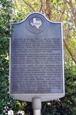
The town of Brazoria began in 1828 as a port and trading center in Stephen F. Austinís colony. Partially burned in 1836 during the Texas Revolution, it rebuilt and served as county seat until 1897. To escape floods and to enjoy a better life, the townspeople moved to “New Town” near the St. Louis, Brownsville, and Mexico Railway in 1912. This town became “Old Town.”
The first traffic bridge, built across the Brazos River in this historic region in 1912, provided a vital link between eastern and western Brazoria County. Falling victim to the elements and lack of maintenance, the wood-decked bridge fell into the river in the 1930s.
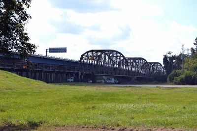
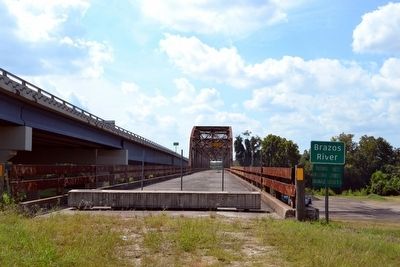
Built in 1939, during the Great Depression, using local labor, county bond money, and funds from the Public Works Administration, this Brazoria Bridge sustains the historic transportation route. Nicknamed “The Bridge That Goes to Nowhere” before the soil embankments were built, this 1124' concrete and steel bridge has three Parker Through Truss spans. It is supported by concrete-filled caisson and concrete piling, and approaches composed of 14 concrete-supported I-beams with steel guard rails. An important example of its style, this Brazoria bridge is a significant part of Brazoria County history.
Recorded Texas Historic Landmark - 1991
Erected 1991 by Texas Historical Commission. (Marker Number 9531.)
Topics. This historical marker is listed in these topic lists: Bridges & Viaducts • Settlements & Settlers. A significant historical year for this entry is 1939.
Location. 29° 3.435′ N, 95° 33.378′ W. Marker is in Brazoria, Texas, in Brazoria County. Marker can be reached from County Road 373 west of Farm to Market Road 521. Touch for map. Marker is in this post office area: Brazoria TX 77422, United States of America. Touch for directions.
Other nearby markers. At least 8 other markers are within walking distance of this marker. Site of Jane Long's Tavern (approx. ľ mile away); Brazoria Townsite (approx. 0.4 miles away); Dr. Sofie Deligath Herzog (approx. 0.4 miles away); Old Brazoria Cemetery (approx. 0.4 miles away); Don Carlos Barrett (approx. half a mile away); Site of the Home of John Austin (approx. 0.6 miles away); Masonic Oak (approx. 0.8 miles away); a different marker also named Masonic Oak (approx. 0.8 miles away). Touch for a list and map of all markers in Brazoria.
Credits. This page was last revised on November 27, 2020. It was originally submitted on October 30, 2015, by Duane Hall of Abilene, Texas. This page has been viewed 726 times since then and 29 times this year. Photos: 1, 2, 3, 4. submitted on October 30, 2015, by Duane Hall of Abilene, Texas.


